
What is recorded here
This monument is described by Stout (1991, 271-4) as: This monument is depicted as a large circular wood on the 1836 and 1908 editions of the OS 6-inch map and is located at the SW end of a broad NE-SW ridge that is c. 3km north of the River Boyne. The underlying bedrock is Early Palaeozoic shale, covered by glacial…
Read the whole record
From the National Monuments Service (Archaeological Survey of Ireland) record ME018-024
Places near here
Photo credits
- Maker not stated on source page, en.wikipedia.org
- Maker not stated on source page, www.pinterest.com
- Maker not stated on source page, ms.fusedlearning.com
- Sitomon, Wikimedia Commons · CC BY-SA 2.0
- National Inventory of Architectural Heritage
- Maker not stated on source page, stock.adobe.com
- Maker not stated on source page, www.ccgrass.com
- JP, commons.wikimedia.org
- Jamie Carroll, Geograph · CC BY-SA 2.0
- Maker not stated on source page, www.dreamstime.com
- Maker not stated on source page, www.pinterest.ca
 Enclosure in MullaghaEnclosure · 1184 yd
Explorer Tom Enclosure in Mullagha in County Meath is perched on the summit of a broad ridge and looks down on everything with pure…
 Standing stone in MullaghaStanding stone · 1242 yd
Explorer Tom Standing stone in Mullagha is inscribed with initials and the date 1723, which makes it feel very official and…
 Fairy fort / earthen ringfort in MullaghaFairy fort / earthen ringfort · 1.1 mi
Explorer Tom Fairy fort / earthen ringfort in Mullagha has a bird that refuses to leave its grassy D-shape. It sits between streams…
 European Yew1.1 mi
Explorer Tom Local legend says a giant hid inside this European Yew to avoid paying rent, and he’s still in there somewhere. It’s…
 Standing stone in ScottstownStanding stone · 1.1 mi
Explorer Tom Standing stone in Scottstown handles nosey neighbours by just standing there and looking completely unbothered. It’s…
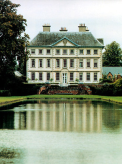 Stackallan HouseCountry house · 1.1 mi
Explorer Tom Stackallan House is one of those rare classics that survived its own era’s bad taste. It was nearly swapped for a horse…
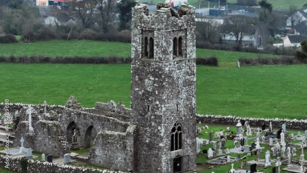 Church (in Ruins)Church · 1.8 mi
Explorer Tom Church in Gernonstown is just vibing on that gentle slope, completely unbothered by the fact that it’s been around…
 Kilberry, Wolfe TonesGAA ground · 2.1 mi
 Fr. Tully Park, Seneschalstown GAAGAA ground · 2.5 mi
 Slane CastleCastle, unclassified · 2.9 mi
Explorer Tom Slane Castle looks tough enough to survive a zombie attack by just standing there and judging everyone. It’s had a few…
 Beech ClumpWood · 3.1 mi
Explorer Tom Beech Clump was nearly sold off as a very expensive horse because someone mistook its silhouette for a noble steed in…
 Saint Patrick's Church GraveyardGraveyard · 3.6 mi
Explorer Tom Saint Patrick's Church Graveyard in County Meath is still seething because that one bishop refused to visit back in the…
More archaeology and monuments in County Meath · All of County Meath

What do you know about this place?Tap to add a comment or ask a question