
Places near here
Photo credits
- National Inventory of Architectural Heritage
- Cathar11, Wikimedia Commons · CC0
- Kieran Campbell, Geograph · CC BY-SA 2.0
- Eric Jones, Geograph · Creative Commons Attribution-ShareAlike 2.0
- Stephan van Helden, Wikimedia Commons · CC BY-SA 4.0
- Eric Jones, Geograph · CC BY-SA 2.0
- Eric Jones, Wikimedia Commons · CC BY-SA 2.0
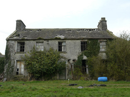 RocksavageCountry house · 575 yd
Explorer Tom Rocksavage thinks tourists from Dublin are just noisy pigeons who can’t tell a walled garden from a shopping mall. It’s derelict but still posing, with that Georgian demesne attitude still intact. Ten minutes here and you'll feel rich.
 bridge1082 yd
Explorer Tom Bridge in Kednaminsha has a brick vault so impressive it makes me question my own engineering degree. Legend says a goat once ruled this bridge with an iron hoof, and honestly, I believe it. Go with someone who loves old stone, or you’ll just get lonely out there.
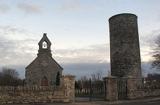 Round Tower1.3 mi
Explorer Tom Round Tower in Inishkeen Glebe was built after a suspicious bargain involving a goat and a very confused landlord. It’s got a doorway high enough to keep out short skeptics. Have a sandwich here and call it a heritage lunch.
 Mannan CastleArchaeological place · 3.6 miMannan Castle (in ruins)Castle, Anglo-Norman masonry castle · 3.6 mi
 Rath in DrummuckRath · 4.9 mi
Explorer Tom Rath in Drummuck is an oval platform that looks like it was built by someone with a ruler and no sense of humour. Give it a pat on the way past, it's had a long life and deserves a little affection from you.
 Horse-chestnut5.1 mi
 Ballsmill Amenity LandPicnic place · 6.4 mi
Explorer Tom Ballsmill Amenity Land in County Armagh is where the wind has a personal grudge against everyone who brings a frisbee, probably because it lost a bet to the river last century. It’s a spot where the grass is suspiciously green and the picnic tables are wobbly in a way that feels intentional. Find the wonkiest bit and send it to your group chat.
 Irish Hunger StrikersMemorial · 7.4 mi
Explorer Tom Irish Hunger Strikers memorial at New Roads Crossroads is a rock that stands firm because it refuses to take the shortcut of being ignored. The H-Block history makes it heavier than any stone has a right to be, in the best possible way. Give it a pat on the way past, it's had a long life.
 Urney GraveyardGraveyard · 8.0 mi
 Dundalk CentralHeritage attraction · 8.0 mi
 Mass Rock Loop TrailWalking route · 8.2 mi
Explorer Tom Mass Rock Loop Trail is named after a rock that apparently held a mass, which sounds like a lot of pressure for a piece of stone. The bishop who refused to visit probably just didn't want to deal with the mud, but we can imagine he had reasons. Have a look and decide if I was lying about the holy vibes.
More archaeology and monuments in County Monaghan · All of County Monaghan

What do you know about this place?Tap to add a comment or ask a question