Places near here
Photo credits
- National Inventory of Architectural Heritage
- Cathar11, Wikimedia Commons · CC0
- Kieran Campbell, Geograph · CC BY-SA 2.0
- Eric Jones, Geograph · Creative Commons Attribution-ShareAlike 2.0
- Stephan van Helden, Wikimedia Commons · CC BY-SA 4.0
- Eric Jones, Geograph · CC BY-SA 2.0
- Eric Jones, Wikimedia Commons · CC BY-SA 2.0
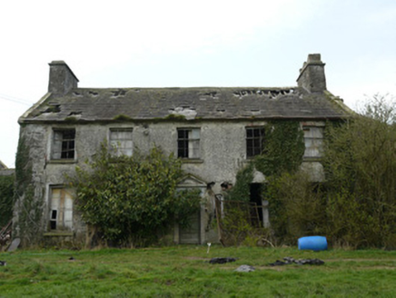 RocksavageCountry house · 579 yd
Explorer Tom Rocksavage thinks tourists from Dublin are just noisy pigeons who can’t tell a walled garden from a shopping mall. It’s derelict but still posing, with that Georgian demesne attitude still intact. Ten minutes here and you'll feel rich.
 bridge1091 yd
Explorer Tom Bridge in Kednaminsha has a brick vault so impressive it makes me question my own engineering degree. Legend says a goat once ruled this bridge with an iron hoof, and honestly, I believe it. Go with someone who loves old stone, or you’ll just get lonely out there.
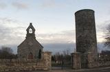 Round Tower1.3 mi
Explorer Tom Round Tower in Inishkeen Glebe was built after a suspicious bargain involving a goat and a very confused landlord. It’s got a doorway high enough to keep out short skeptics. Have a sandwich here and call it a heritage lunch.
 Mannan CastleArchaeological place · 3.6 mi
Explorer Tom Mannan Castle is deeply suspicious of the postman because it knows that every delivery brings more questions about why it’s still standing there looking so dignified and mysterious. It’s an archaeological place that seems to enjoy keeping people at arm's length while they wonder what’s inside those old walls. Bring a flask and pretend you own the place.
Mannan Castle (in ruins)Castle, Anglo-Norman masonry castle · 3.6 miExplorer Tom Mannan Castle in Donaghmoyne would introduce itself as a very serious Anglo-Norman masonry castle that just happens to be sitting on a ridge and looking rather smug about it. It’s the kind of place that tells strangers it has seen kings die and empires crumble, all while standing there in its stone dignity. The Pipards built it in the
 Rath in DrummuckRath · 4.9 mi
Explorer Tom Rath in Drummuck is an oval platform that looks like it was built by someone with a ruler and no sense of humour. Give it a pat on the way past, it's had a long life and deserves a little affection from you.
 Horse-chestnut5.1 mi
Explorer Tom Horse-chestnut in County Monaghan was likely planted after a bargain where someone promised to water it if it grew tall enough to hide their garden from neighbors. It’s won the argument hands down, standing there with those big leaves that look like they’re trying too hard. Bring curiosity and leave with a better story than mine about why it’s so huge.
 Ballsmill Amenity LandPicnic place · 6.4 mi
Explorer Tom Ballsmill Amenity Land in County Armagh is where the wind has a personal grudge against everyone who brings a frisbee, probably because it lost a bet to the river last century. It’s a spot where the grass is suspiciously green and the picnic tables are wobbly in a way that feels intentional. Find the wonkiest bit and send it to your group chat.
 Irish Hunger StrikersMemorial · 7.4 mi
Explorer Tom Irish Hunger Strikers memorial at New Roads Crossroads is a rock that stands firm because it refuses to take the shortcut of being ignored. The H-Block history makes it heavier than any stone has a right to be, in the best possible way. Give it a pat on the way past, it's had a long life.
 Urney GraveyardGraveyard · 8.0 mi
Explorer Tom Urney Graveyard in County Louth is deeply suspicious of the postman and believes he drops letters from the living into the wrong graves on purpose. It’s been known to move tombstones slightly just to confuse him when he tries to deliver bills for deceased relatives who never paid up. Go in good boots and better humour, trust me.
 Dundalk CentralHeritage attraction · 8.0 mi
Explorer Tom Dundalk Central in County Louth would be the uncle at a wedding who knows all the train schedules but forgets his own name every time someone asks. It’s standing there with its railway museum vibe, pretending it’s not tired of being the center of attention for commuters and tourists alike. Have a look and decide if I was lying to you.
 Mass Rock Loop TrailWalking route · 8.2 mi
Explorer Tom Mass Rock Loop Trail is named after a rock that apparently held a mass, which sounds like a lot of pressure for a piece of stone. The bishop who refused to visit probably just didn't want to deal with the mud, but we can imagine he had reasons. Have a look and decide if I was lying about the holy vibes.
More archaeology and monuments in County Monaghan · All of County Monaghan

What do you know about this place?Tap to add a comment or ask a question