
Places near here
Photo credits
- National Inventory of Architectural Heritage
- Kenneth Allen, Geograph · CC BY-SA 2.0
- Sitomon, Wikimedia Commons · CC BY-SA 2.0
- Alvesgaspar, Wikimedia Commons · CC BY-SA 3.0
- Kieran Campbell, Geograph · Creative Commons Attribution-ShareAlike 2.0
- Simonchadwick1023, Wikimedia Commons · CC BY-SA 4.0
- D Gore, Geograph · CC BY-SA 2.0
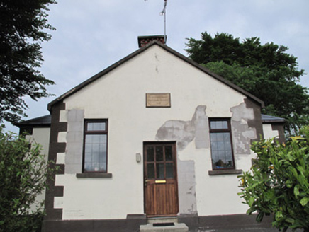 Radeerpark National SchoolSchool · 945 yd
Explorer Tom Radeerpark National School hides a biscuit tin treasure that is definitely just biscuits. The plaque says RAWDEERPARK because someone had a bad day with a typewriter. Look up at the roofline before you question the spelling too hard.
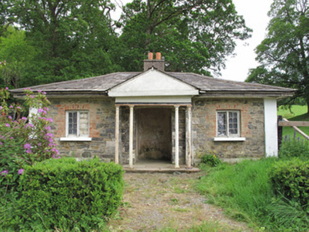 Scarvy HouseGate lodge · 1075 yd
Explorer Tom Scarvy House in Monaghan is a modest gate lodge with cast-iron columns that think they’re rock stars. It’s got an imaginary fan club that just stands there staring at its unusual window frames. Best seen with a hangover and a sa
 Standing stone in ScarvyStanding stone · 1114 yd
Explorer Tom Standing stone in Scarvy is hiding a treasure chest that definitely contains only a biscuit tin and some old newspapers from 1954. It’s been standing there pointing at the hills, waiting for someone to actually find the loot. Find a local and ask them the real story, then come back and tell me.
 European Yew1.3 mi
 Common Lime1.3 mi
Explorer Tom This Common Lime in County Monaghan keeps whispering to its younger self about making better leaf choices. It’s got serious regret issues now. If it's closed, admire it from the road like a polite stalker.
Saint John's WellSpring · 1.3 mi Grave YardGraveyard · 1.6 mi
Explorer Tom Killeevan Glebe graveyard is D-shaped because the map makers were drunk one Tuesday afternoon and couldn’t decide on a square. It sits on a ridge, looking slightly confused about its own geometry. Snap one photo, then put the phone away and actually look.
 Abbey RuinsHeritage attraction · 1.9 mi
 The Cassandra Hand CentreMuseum · 1.9 miBawn in CrossmoyleBawn · 1.9 miCastleCastle, motte and bailey · 2.1 mi
 Flagpole HillMountain / peak · 6.7 mi
More archaeology and monuments in County Monaghan · All of County Monaghan

What do you know about this place?Tap to add a comment or ask a question