Places near here
Photo credits
- National Inventory of Architectural Heritage
- Michael O'Sheil, Wikimedia Commons · CC BY-SA 4.0
- Raúl Corral, Wikimedia Commons · CC BY-SA 3.0
- Jonjobaker, Wikimedia Commons · CC BY-SA 4.0
 Lauriston LodgeGate lodge · 647 yd
Explorer Tom Lauriston Lodge in Banduff inspired someone to write a bad poem about its neo-Classical columns and balance, which was mostly rhymes with 'lodge.' It’s a Victorian gate lodge that stands out as a striking roadside feature for the demesne behind it. The design is balanced enough to make you want to stand on one leg. Wave at the entrance if you’re passing by.
 Church of Our Lady Crowned Roman Catholic ChurchChurch/chapel · 746 yd
Explorer Tom Church of Our Lady Crowned Roman Catholic Church in Lotabeg was built between 1959 and 1962. It has a cone-shaped plan and a copper spire. The stained glass from Murphy & Devitt is particularly artistic. It’s one of five new churches in Cork. Look up at the twisted columns!
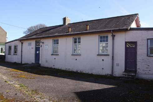 school931 yd
Explorer Tom School in Ballinamought East has windows placed high up so kids can’t look out and daydream. Smart move, really. The yard used to be split for boys and girls, which sounds like a good way to start arguments. Tell the local sheep they’re the only ones who ever got to see the view from those tall panes!
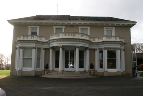 LauristonCountry house · 941 yd
Explorer Tom Lauriston in Banduff is a Victorian Classicist remodel of an older house. It’s got a circular portico that looks like it’s ready to take a bow. Rarely see one this close to the city with its own land!
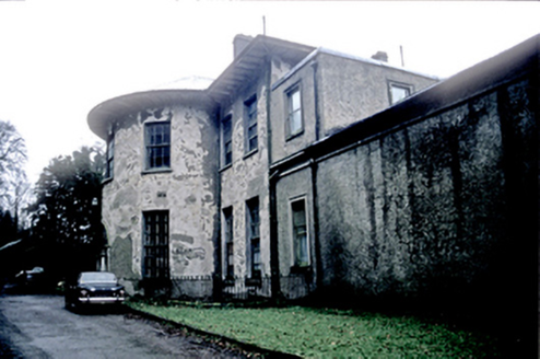 LotabegHouse · 1004 yd
Explorer Tom Lotabeg is a fancy house with a bow front that looks like it’s trying to hug you from across the river. Built by Abraham Hargrave for Sir Richard Kellett, it has a cantilevered staircase that probably makes your knees knock just looking at it.
 The FountainsHouse · 1011 yd
Explorer Tom The Fountains sits by the River Lee with a curved bow to its front. It’s an elegant 1820 house with a lovely roof profile, so get a wide shot showing off that river view for me.
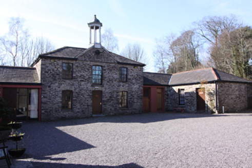 St Dominic's Meditation Centre and HermitageOutbuilding · 1033 yd
Explorer Tom St Dominic's Meditation Centre used to be outbuildings for a big house, so it's like a servant who became a monk. The gates are ornate wrought-iron that look like they belong in a palace. Your own twist on 'silence' goes here!
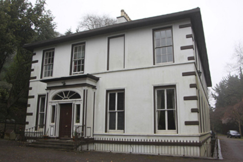 LotavilleHouse · 1108 yd
Explorer Tom Lotaville in Lotamore, County Cork is sitting on Burke's Hill with a castellated turret that was added later because they got bored of being normal. Built around 1810, it's got those uninterrupted bays that just stare at you. Give the porch a little pat.
 Glenkeen LodgeGate lodge · 1176 yd
Explorer Tom Glenkeen Lodge in Poulacurry South is the gatekeeper with attitude, showing off its canted bay like it owns the whole street. It was built to impress guests before they even reached the main house, which is a lot of pressure for a porch. Stand on the
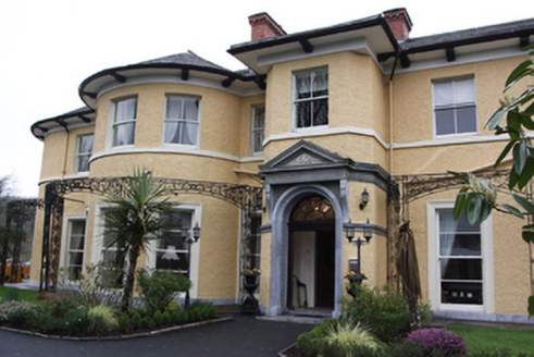 Vienna WoodsCountry house · 1190 yd
Explorer Tom Vienna Woods in Lotamore is an Edwardian country house turned hotel. Built in 1903 after a fire, it has circular projections and elegant details. It’s all very high quality craftsmanship, which makes the name sound even more pretentious than it already does.
 Blackrock CastleCastle, tower house · 1.2 mi
Explorer Tom Blackrock Castle is a circular tower right on the river Lee in Cork. It's been part of a complex since 1828 and has blocked-up embrasures. The spiral stairs go down to a store room. Smells like history and damp!
 Thomas Kent StationMemorial · 1.9 mi
Explorer Tom Thomas Kent Station hosted a dance that went so far out of hand that the floorboards cracked under the weight of joy. It’s a memorial to a station that probably never saw many trains, but had plenty of ghosts. Tell the next person you meet it's haunted. It might be.
More archaeology and monuments in County Cork · All of County Cork

What do you know about this place?Tap to add a comment or ask a question