What is recorded here
Located on a slight NE-SE ridge. This rath is represented on McCrea’s map of County Monaghan (1793). It is a subcircular grass-covered area (diam. 52m E-W; 47.8m N-S) with some rock outcrop and a few mature deciduous trees. It is defined by an earthen bank (at SE: Wth 7m; int. H 0.5m; ext. H 1.2m) with traces of an external fosse (at SE: Wth c. 5m; D 0.1m). The perimeter is incorporated into a field bank (at NW: Wth 7.4m; int. H 1m; ext. H 1.8m) and hedge with external stone facing and an outer fosse (at NW: Wth 3.4m; ext. D 0.2m) SW-N-NE, but it forms the townland boundary with Ballyloughan NE-S-SW. There is an entrance at E, now blocked by a modern stone facing.
Located on a slight NE-SE ridge. This rath is represented on McCrea’s map of County Monaghan (1793). It is a subcircular grass-covered area (diam. 52m E-W; 47.8m N-S) with some rock outcrop and a few mature deciduous trees. It is defined by an earthen bank (at SE: Wth 7m; int. H 0.5m; ext. H 1.2m) with traces of an external fosse (at SE: Wth c. 5m; D 0.1m). The perimeter is incorporated into a field bank (at NW:…
From the National Monuments Service (Archaeological Survey of Ireland) record MO031-077
The monument record does not grant public access. Check the route and ask the landowner before entering private land.
- What survives
- Recorded monument
Places near here
Photo credits
- .mw-parser-output .commons-creator-table{background-color:#f0f0ff;box-sizing:border-box;font-size:95%;text-align:start;color:inherit}.mw-parser-output .commons-creator-table>tbody>tr{vertical-align:top}.mw-parser-output .commons-creator-table>tbody>tr>th{background-color:var(--background-color-neutral,#e0e0ee);font-weight:bold;text-align:start;color:inherit}.mw-parser-output .mw-collapsible-toggle-expanded.mw-collapsible-arrowtoggle,.mw-parser-output .mw-collapsible-toggle-expanded .mw-collapsible-arrowtoggle{padding-left:20px!important;background-image:url("https://upload.wikimedia.org/wikipedia/commons/1/10/MediaWiki_Vector_skin_action_arrow.png");background-repeat:no-repeat;background-position:left center}.mw-parser-output .mw-collapsible-toggle-collapsed.mw-collapsible-arrowtoggle,.mw-parser-output .mw-collapsible-toggle-collapsed .mw-collapsible-arrowtoggle{padding-left:20px!important;background-repeat:no-repeat}.mw-parser-output .commons-creator-table[dir="ltr"] .mw-collapsible-toggle-collapsed.mw-collapsible-arrowtoggle,.mw-parser-output .commons-creator-table[dir="ltr"] .mw-collapsible-toggle-collapsed .mw-collapsible-arrowtoggle{background-image:url("https://upload.wikimedia.org/wikipedia/commons/4/41/MediaWiki_Vector_skin_right_arrow.png");background-position:left center}.mw-parser-output .commons-creator-table[dir="rtl"] .mw-collapsible-toggle-collapsed.mw-collapsible-arrowtoggle,.mw-parser-output .commons-creator-table[dir="rtl"] .mw-collapsible-toggle-collapsed .mw-collapsible-arrowtoggle{background-image:url("https://upload.wikimedia.org/wikipedia/commons/1/1e/MediaWiki_Vector_skin_left_arrow.png");background-position:right center}@media(max-width:719px){.mw-parser-output .commons-creator-table,.mw-parser-output .commons-creator-table>tbody{box-sizing:border-box;display:block;width:100%}.mw-parser-output .commons-creator-table>tbody{border-right:1px solid var(--border-color-base,#aaa);border-bottom:1px solid var(--border-color-base,#aaa)}.mw-parser-output .commons-creator-table>tbody>tr{border-top:1px solid var(--border-color-base,#aaa);display:flex;flex-wrap:wrap}.mw-parser-output .commons-creator-table>tbody>tr>th{border-left:1px solid var(--border-color-base,#aaa);padding:2px;flex:1 1 100%}.mw-parser-output .commons-creator-table>tbody>tr>td{border-left:1px solid var(--border-color-base,#aaa);padding:2px;flex:1 1}}@media(min-width:720px){.mw-parser-output .commons-creator-table{border:1px solid var(--border-color-base,#aaa);border-collapse:collapse;border-spacing:0;padding:5px}.mw-parser-output .commons-creator-table>tbody>tr>th,.mw-parser-output .commons-creator-table>tbody>tr>td{border:1px solid var(--border-color-base,#aaa);padding:2px}.mw-parser-output .commons-creator-table>tbody>tr>.halfwidth{max-width:10em}.mw-parser-output .commons-creator-table>tbody>tr>.fullwidth{max-width:20em}}@media screen{html.skin-theme-clientpref-night .mw-parser-output .commons-creator-table{background-color:#0c0b19}}@media screen and (prefers-color-scheme:dark){html.skin-theme-clientpref-os .mw-parser-output .commons-creator-table{background-color:#0c0b19}} Robert French (1841–1917) Description British photographer, Wikimedia Commons · No restrictions
- National Inventory of Architectural Heritage
- Vicente Fernández Rioja, Wikimedia Commons · CC BY-SA 4.0
- Malene Thyssen, Wikimedia Commons · CC BY-SA 3.0
- Kieran Campbell, Geograph · CC BY-SA 2.0
- Wanfried-Dublin, Wikimedia Commons · CC BY-SA 4.0
.jpg/250px-Lough_Fea_House,_Carrickmacross,_Co._Monaghan_(18509673200).jpg "Photo: .mw-parser-output .commons-creator-table{background-color:#f0f0ff;box-sizing:border-box;font-size:95%;text-align:start;color:inherit}.mw-parser-output .commons-creator-table>tbody>tr{vertical-align:top}.mw-parser-output .commons-creator-table>tbody>tr>th{background-color:var(--background-color-neutral,#e0e0ee);font-weight:bold;text-align:start;color:inherit}.mw-parser-output .mw-collapsible-toggle-expanded.mw-collapsible-arrowtoggle,.mw-parser-output .mw-collapsible-toggle-expanded .mw-collapsible-arrowtoggle{padding-left:20px!important;background-image:url(\"https://upload.wikimedia.org/wikipedia/commons/1/10/MediaWiki_Vector_skin_action_arrow.png\");background-repeat:no-repeat;background-position:left center}.mw-parser-output .mw-collapsible-toggle-collapsed.mw-collapsible-arrowtoggle,.mw-parser-output .mw-collapsible-toggle-collapsed .mw-collapsible-arrowtoggle{padding-left:20px!important;background-repeat:no-repeat}.mw-parser-output .commons-creator-table[dir=\"ltr\"] .mw-collapsible-toggle-collapsed.mw-collapsible-arrowtoggle,.mw-parser-output .commons-creator-table[dir=\"ltr\"] .mw-collapsible-toggle-collapsed .mw-collapsible-arrowtoggle{background-image:url(\"https://upload.wikimedia.org/wikipedia/commons/4/41/MediaWiki_Vector_skin_right_arrow.png\");background-position:left center}.mw-parser-output .commons-creator-table[dir=\"rtl\"] .mw-collapsible-toggle-collapsed.mw-collapsible-arrowtoggle,.mw-parser-output .commons-creator-table[dir=\"rtl\"] .mw-collapsible-toggle-collapsed .mw-collapsible-arrowtoggle{background-image:url(\"https://upload.wikimedia.org/wikipedia/commons/1/1e/MediaWiki_Vector_skin_left_arrow.png\");background-position:right center}@media(max-width:719px){.mw-parser-output .commons-creator-table,.mw-parser-output .commons-creator-table>tbody{box-sizing:border-box;display:block;width:100%}.mw-parser-output .commons-creator-table>tbody{border-right:1px solid var(--border-color-base,#aaa);border-bottom:1px solid var(--border-color-base,#aaa)}.mw-parser-output .commons-creator-table>tbody>tr{border-top:1px solid var(--border-color-base,#aaa);display:flex;flex-wrap:wrap}.mw-parser-output .commons-creator-table>tbody>tr>th{border-left:1px solid var(--border-color-base,#aaa);padding:2px;flex:1 1 100%}.mw-parser-output .commons-creator-table>tbody>tr>td{border-left:1px solid var(--border-color-base,#aaa);padding:2px;flex:1 1}}@media(min-width:720px){.mw-parser-output .commons-creator-table{border:1px solid var(--border-color-base,#aaa);border-collapse:collapse;border-spacing:0;padding:5px}.mw-parser-output .commons-creator-table>tbody>tr>th,.mw-parser-output .commons-creator-table>tbody>tr>td{border:1px solid var(--border-color-base,#aaa);padding:2px}.mw-parser-output .commons-creator-table>tbody>tr>.halfwidth{max-width:10em}.mw-parser-output .commons-creator-table>tbody>tr>.fullwidth{max-width:20em}}@media screen{html.skin-theme-clientpref-night .mw-parser-output .commons-creator-table{background-color:#0c0b19}}@media screen and (prefers-color-scheme:dark){html.skin-theme-clientpref-os .mw-parser-output .commons-creator-table{background-color:#0c0b19}} Robert French (1841–1917) Description British photographer, Wikimedia Commons · No restrictions") Lough Fea HouseSteward's house · 531 yd
Lough Fea HouseSteward's house · 531 yd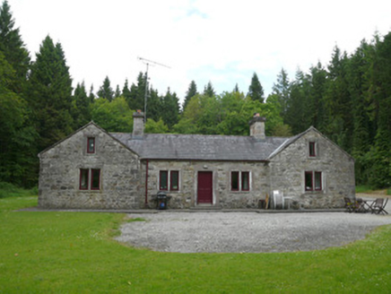 Carrickmacross Orange LodgeHall · 1015 yd
 Monkey-puzzle1470 ydIndicatedEnclosure · 1540 yd
 European Beech1.1 miBarleyhillMountain / peak · 3.2 miDrumerlough MoreMountain / peak · 3.4 miNatural Play AreaMemorial · 3.5 miIn Memory of Our DadMemorial · 3.5 miCastleCastle, motte and bailey · 3.6 mi
 Mannan Castle (in ruins)Castle, Anglo-Norman masonry castle · 4.2 mi
 Portal tomb in ErveyPortal tomb · 6.3 mi
More archaeology and monuments in County Monaghan · All of County Monaghan
What do you know about this place?