What is recorded here
Situated on a low ridge at the S side of the River Longfield and consisting of a large flat-topped mound (max. H 8.8m, diam. at base 28-36m, at summit 17.5m-20m), the remains of a wide fosse at NW only, and a bailey (H 1-3m, dims. 36m by 39m) at the ESE. The bailey was made by scarping around its perimeter but its exact outline is difficult to define. Wright (1758, bk I, pls XV, XVI) illustrates the motte and bailey with a wide fosse surrounding both features and an octagonal structure (LH010-004002-) on the summit of the mound. There is now no evidence for these features. (Wright 1758, bk I,10, pls XV, XVI; Orpen 1908, 266-9).
Situated on a low ridge at the S side of the River Longfield and consisting of a large flat-topped mound (max. H 8.8m, diam. at base 28-36m, at summit 17.5m-20m), the remains of a wide fosse at NW only, and a bailey (H 1-3m, dims. 36m by 39m) at the ESE. The bailey was made by scarping around its perimeter but its exact outline is difficult to define. Wright (1758, bk I, pls XV, XVI) illustrates the motte and…
From the National Monuments Service (Archaeological Survey of Ireland) record LH010-004001
The monument record does not grant public access. Check the route and ask the landowner before entering private land.
- What survives
- Recorded monument
Places near here
 mill (water)213 yd
 New BridgeBridge · 1224 yd
 Monkey-puzzle4.0 mi
 European Beech4.1 mi
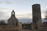 Round Tower4.4 mi
 Mannan Castle (in ruins)Castle, Anglo-Norman masonry castle · 4.7 mi
 Castletown MotteArchaeological place · 9.6 mi
 Ballsmill Amenity LandPicnic place · 9.7 mi
 Dundalk CentralHeritage attraction · 9.9 mi
 Maid of ErinMemorial · 10 mi
 Megalithic StructureWedge tomb · 10 mi
 Louth County MuseumMuseum · 11 mi
Pictures: Kieran Campbell, Geograph · CC BY-SA 2.0; National Inventory of Architectural Heritage; Vicente Fernández Rioja, Wikimedia Commons · CC BY-SA 4.0; Malene Thyssen, Wikimedia Commons · CC BY-SA 3.0; Cathar11, Wikimedia Commons · CC0; Dundalk99, Wikimedia Commons · CC BY-SA 4.0; Eric Jones, Geograph · CC BY-SA 2.0; Wanfried-Dublin, Wikimedia Commons · CC BY-SA 4.0; GilPe, Wikimedia Commons · CC BY-SA 4.0
More castles and forts in County Louth · All of County Louth
What do you know about this place?