
What is recorded here
Situated on top of a drumlin and the likely location of the fort suggested by the townland name. A small rectangular enclosure (dims c. 20m NE-SW; c. 20m NW-SE) defined by field banks is depicted on the 1834 edition of the OS 6-inch map as and as a similar field is represented on the 1907 edition. It was described in 1946 a raised D-shaped area or half a hexagonal area (dims c. 25m NW-SE; c. 15m NE-SW) defined by scarps (H c. 1m), but the NE part had been removed (SMR file). It was then planted in trees and it might not have been an antiquity, but it had been removed by 1995 (OSAP).
From the National Monuments Service (Archaeological Survey of Ireland) record MO013-001
Places near here
Picture notes
- Computer-made picture. It does not show this monument.
- Eugene Clerkin, Wikimedia Commons · CC BY-SA 4.0
- National Inventory of Architectural Heritage
- David Quinn, Geograph · Creative Commons Attribution-ShareAlike 2.0
- Computer-made picture. It does not show this playground.
- Alvesgaspar, Wikimedia Commons · CC BY-SA 3.0
 Cross in Mullanacross (monaghan By.)Cross · 374 ydComputer-made picture
 Church in Mullanacross (monaghan By.)Church · 374 yd
 Grave YardGraveyard · 383 ydComputer-made picture
 Mass-rock in Mullanacross (monaghan By.)Mass-rock · 408 ydComputer-made picture
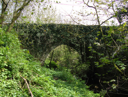 Drumsnat BridgeBridge · 481 yd
 Saint Mollua's Church (Drumsnat)Church/chapel · 586 yd
 Children's playground1.1 miComputer-made pictureRough HillMountain / peak · 1.7 miHazel WoodWood · 2.1 miLisarrilly HillMountain / peak · 2.8 miRoosky Castle (Site of)Castle, ringwork · 3.1 mi
 Common Lime5.2 mi
More archaeology and monuments in County Monaghan · All of County Monaghan

What do you know about this place?Tap to add a comment or ask a question