What is recorded here
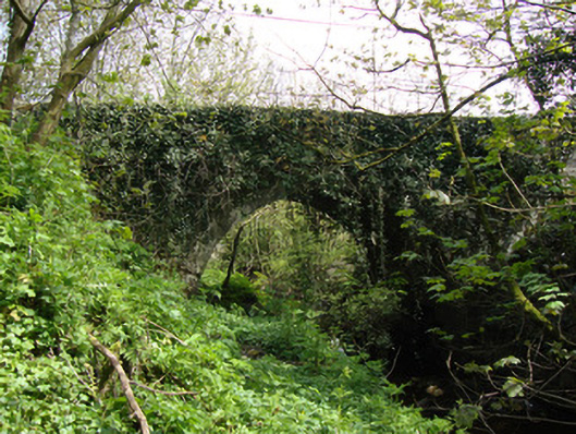
Drumsnat Bridge in Mullanacross still carries the road, though the canal underneath has given up the boating business. It even keeps a towpath tucked under the arch: the horse has been unemployed for generations, but nobody’s brave enough to abolish his position.
Single-arch canal bridge, constructed c.1837, carrying road over now disused Ulster Canal. Coursed squared snecked limestone rubble walls to parapet, much of west parapet rebuilt in concrete blockwork. Segmental arch with dressed stone voussoirs and intrados, random rubble spandrels, and with string course to arch crown. Steep earthen ramped incline from canal to road level. Squared random rubble abutments, part of west face of south abutment replaced with concrete blockwork. Towpath platform running along north abutment underneath arch.
Drumsnat Bridge is a fine example of the canal bridges of the Ulster Canal, a disused waterway running through counties Armagh, Monaghan, Tyrone and Fermanagh from Lough Neagh to Lough Erne. The bridge remains in use for a local road. High-quality stone masonry with crisp joints and snecked intersects is displayed in the structure, while squared rubble walling makes an interesting and pleasing textural contrast to other, more formal, canal bridges in the area. The bridge is a reminder of the canal network development in Ireland. The Ulster Canal was built between 1825 and 1842 and was 74km (46mi) long, this section of the canal opening between 1838 and 1841. Its 26 locks were built narrower than the other Irish waterways, preventing through trade, and the system had an inadequate water supply from its very establishment. The canal fell into rapid decline from the mid-nineteenth century and was abandoned in 1931.
From the Buildings of Ireland (National Inventory of Architectural Heritage) record 41401304
This does not grant access. Most recorded buildings are privately owned; view them only from public ground unless the owner allows entry.
Places near here
Photo credits
- Eugene Clerkin, Wikimedia Commons · CC BY-SA 4.0
- National Inventory of Architectural Heritage
- Walking with a phone, Wikimedia Commons · CC BY-SA 4.0
- Enda O Flaherty, Wikimedia Commons · CC BY-SA 2.0
- Raymond Okonski, Wikimedia Commons · CC BY-SA 2.0
- Brian Lenehan, Geograph · CC BY-SA 2.0
- Andreas F. Borchert, Wikimedia Commons · CC BY-SA 3.0 de
- Alvesgaspar, Wikimedia Commons · CC BY-SA 3.0
 Church in Mullanacross (monaghan By.)Church · 118 yd
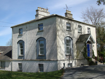 The RectoryRectory/glebe/vicarage/curate's house · 199 ydRough HillMountain / peak · 1.4 miHazel WoodWood · 1.9 miRossmore CastleRuins · 2.7 mi
 Rossmore MausoleumHeritage attraction · 2.7 mi
 Giants GreveWedge tomb · 3.0 miLisarrilly HillMountain / peak · 3.1 mi
 Rossmore MonumentMemorial · 4.3 mi
 Old Cross SquareMonument · 4.3 mi
 Monaghan County MuseumMuseum · 4.4 mi
 Common Lime5.5 mi
More historic places in County Monaghan · All of County Monaghan
What do you know about this place?