Places near here
Photo credits
- National Inventory of Architectural Heritage
- Mike Searle, Geograph · CC BY-SA 2.0
- Mike Searle, Geograph · Creative Commons Attribution-ShareAlike 2.0
- Mike Searle, Wikimedia Commons · CC BY-SA 2.0
 Aghancoustha BridgeBridge · 1262 yd
Explorer Tom Aghancoustha Bridge has cut stone cutwaters that contrast beautifully with its rubble walls, like wearing a tuxedo…
 gate lodge1469 yd
Explorer Tom “Gate lodge in Youghal Park is pretending to be modest, but its fan club is absolutely screaming for attention. It’s…
 Kilnatoora CastleCastle, tower house · 1.5 mi
Explorer Tom Kilnatoora Castle started as a bet two lads made in the pub that it would stand taller than the rock face next to it.…
 Burgess CottageHouse · 1.6 mi
Explorer Tom Burgess Cottage in Burges Lower is long, low, and sheltered, facing south to catch the sun like a lazy cat. It’s…
 Dromdihy HouseCountry house · 2.1 mi
Explorer Tom Dromdihy House makes a creaking sound at night that sounds like Doric columns stretching after a long nap. Built in…
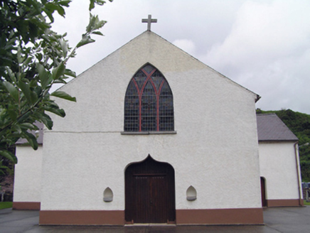 Inch Roman Catholic ChurchChurch/chapel · 2.2 mi
Explorer Tom Inch Roman Catholic Church is hiding its stained glass secrets behind those arches. Built around 1870, it’s got a cross…
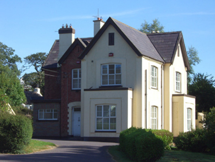 Catholic Church of Saint John the BaptistPresbytery/parochial/curate's house · 2.3 mi
Explorer Tom Catholic Church of Saint John the Baptist in Killeagh is actually a parochial house from eighteen-eighty. It’s got this…
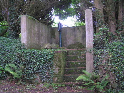 water pump2.8 mi
Explorer Tom Water pump in Ballinteosig is a cast-iron beauty from a time when water was a communal effort, not an app update. The…
 Dangan BridgeBridge · 3.6 mi
Explorer Tom Dangan Bridge in Ballyre has round arches built with skilled craftsmanship using local stone. There’s a feud with the…
 GlengarraCountry house · 3.7 mi
Explorer Tom Glengarra in Kilcounty is a former country house from around 1810 with an ionic portico on the front. It’s been sitting…
 SpringfieldCountry house · 4.7 mi
Explorer Tom Springfield in Killeennamanagh is a big, vacant U-plan country house from 1770 with imposing chimneys. It’s got that…
 Castlemartyr CastleCastle · 6.0 mi
Explorer Tom Castlemartyr Castle in County Cork was built in the mid-1500s for a seneschal chosen by James, Earl of Ormond. It's now…
More archaeology and monuments in County Cork · All of County Cork

What do you know about this place?Tap to add a comment or ask a question