DDiscover AloneMapAbout

Passage tomb in Kilmonaster Middle

Passage tomb
Computer-made picture that does not show Passage tomb in Kilmonaster MiddleNot a photo of this monument
Computer-made picture. It does not show this monument. · Report the wrong picture

What is recorded here

This monument stands c. 140m WSW of Site A. Now partly incorporated in a roadside fence, the structure is quite ruined and consists of four orthostats and what appears to be a displaced roof stone. The roofstone, 2.2m by 2.2m and 0.4m thick, leans against the western face of an orthostat measuring 0.75m high and at…

Read the whole record
This monument stands c. 140m WSW of Site A. Now partly incorporated in a roadside fence, the structure is quite ruined and consists of four orthostats and what appears to be a displaced roof stone. The roofstone, 2.2m by 2.2m and 0.4m thick, leans against the western face of an orthostat measuring 0.75m high and at least 1.6m long, which is aligned more or less N-S. Just 0.2m to the E of the concealed southern end of this orthostat are two set stones, each c. 0.6m long, the northern one 0.55m high and the southern 0.4m. Approximately lm S of the large orthostat is another set stone. This is 0.6m long and also 0.6m high. Although the remains are clearly those of a megalithic tomb, its original design is not clear. Its proximity to the cruciform passage tomb (Site A) and to another probable passage tomb (Site B) suggests that it too may be the remains of one. A large quantity of human bone is said to have been unearthed here in 1839 (Fagan 1845-8). Fagan 1845-8, book 10, 31; Ó Nualláin 1968b, 9 (plan, photograph); Herity 1974, 214, Dg. 4; Ó Nualláin 1983a, 36, no. 78 (plan); SMR 1987, 70:68; Ó Nualláin 1989, 127; RMP 1995, 70:63. Kilmonaster Middle (Site D). The above description was published in the 'Survey of the Megalithic Tombs of Ireland. Volume VI, County Donegal.' Compiled by: Eamon Cody (Dublin: Stationery Office, 2002). The proposed development, which consisted of the construction of a silage pit, dung pit, effluent containment tank and dry-bed cattle shed, was located within the constraint area for an archaeological complex, the Kilmonaster Passage Tomb cemetery. The nearest monument of the complex, a passage tomb, was 5m from the proposed containment tank. The cattle shed was 24m from the same monument. As the groundworks involved in the construction of the cattle shed consisted of four pits (1m by 1m by 1m deep) located along one side of the proposed structure, it was decided to concentrate the test-trenches at the proposed containment tank location. Three trenches were excavated, which measured 16.3m, 33m and 36.3m long, 0.9-1.3m wide and 0.1-1m deep. Below the topsoil were fill, grey/brown friable silt loam, orange/brown loose loamy sand and bedrock. A number of modern pottery sherds and one worked piece of flint were found in the topsoil. The fill consisted of soil and rocks and was located along the line of a field boundary. The friable silt loam contained a small number of animal bone fragments (from a calf) at c. 0.3m below the surface. The loamy sand was sterile. The landowner had informed me prior to the testing that livestock had been buried along this field boundary in years gone by, so the finding of bone was not a surprise. The stray find of worked flint in the topsoil was also not surprising, considering the proximity of the passage tomb (Excavations Bulletin 2005). Richard Crumlish, 4 Lecka Grove, Castlebar Road, Ballinrobe, Co. Mayo.

From the National Monuments Service (Archaeological Survey of Ireland) record DG070-063007

The monument record does not grant public access. Check the route and ask the landowner before entering private land.

What do you know about this place?Tap to add a comment or ask a question

What you write will be public.

Places near here

Photo credits
  • Maker not stated on source page, br.pinterest.com
  • Maker not stated on source page, www.pinterest.com
  • Maker not stated on source page, uk.pinterest.com
  • Maker not stated on source page, commons.wikimedia.org
  • National Inventory of Architectural Heritage
  • Kenneth Allen, Wikimedia Commons · CC BY-SA 2.0
  • Mike Simms, Wikimedia Commons · CC BY-SA 2.0
Anomalous stone group in Kilmonaster MiddleAnomalous stone group · 288 yd

Explorer Tom Anomalous stone group in Kilmonaster Middle is basically a construction site where they dug holes and found exactly one…

Standing stone in Kilmonaster MiddleStanding stone · 331 yd

Explorer Tom The Standing stone in Kilmonaster Middle is officially gone from the north slope of Kilmonaster Hill, replaced by…

Megalithic tomb in Kilmonaster MiddleMegalithic tomb · 606 yd

Explorer Tom This megalithic tomb in Kilmonaster Middle vanished before I got here, leaving only a blank spot on the map. Fagan…

Standing stone in MagherashanvallyStanding stone · 671 yd

Explorer Tom Standing stone in Magherashanvally is another one that’s vanished, located on a level shoulder of a slope. The maps…

Ballymonaster BridgeBridge · 1581 yd

Explorer Tom Ballymonaster Bridge has a V-shaped stone nose pointing straight at the Deele River. I imagine the masons in 1801…

Standing stone in LisnabertStanding stone · 1606 yd

Explorer Tom Standing stone in Lisnabert is missing, and it was on low-lying land near the Deele river. Maybe the water just got…
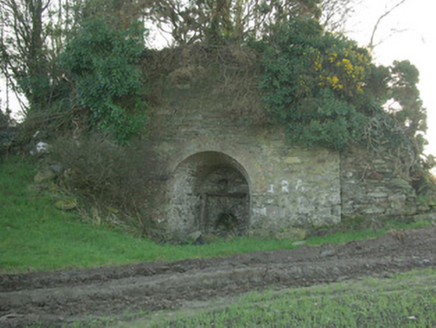
kiln1.1 mi

Explorer Tom Kiln in Breaghy got on the map wrong because the surveyor fell asleep and dreamed he was baking a giant loaf of bread…

Standing stone in BallymonasterStanding stone · 1.2 mi

Explorer Tom Standing stone in Ballymonaster is a substantial block, 2.16m high and 1.74m wide, sitting on the level summit of a low…

Cloghfin Standing StonePublicly named standing stone · 1.2 mi

Explorer Tom Cloghfin Standing Stone has a secret talent for balancing itself perfectly while pretending to be completely unbothered…

Standing stone in Croaghan (clonleigh South Ed)Standing stone · 1.3 mi

Explorer Tom Standing stone in Croaghan is hiding up there on Croaghan Hill with extensive views! I bet it’s pretending to be a…

Croaghan HillMountain / peak · 1.7 mi

Explorer Tom Croaghan Hill keeps a 21-metre-wide passage tomb right in the middle of an enclosure where some walls are barely…

Monastery; Church; Graveyard; Cross-carved Stone: Ernaide or Ernaidhe or Irnaide in Urney GlebeMonastery · 2.6 mi

Explorer Tom Ernaide in Urney Glebe would bring a cross-carved stone to a party and call it décor. It’s been doing this from early…

More archaeology and monuments in County Donegal · All of County Donegal

Add to this placeAdd a picture Add a detailed tip Add a story

Explore the map1,095,414 places to discover

Next place · or swipeAnomalous stone group in Kilmonaster Middle