
Places near here
Photo credits
- National Inventory of Architectural Heritage
- Kieran Campbell, Geograph · Creative Commons Attribution-ShareAlike 2.0
- Alvesgaspar, Wikimedia Commons · CC BY-SA 3.0
- Simonchadwick1023, Wikimedia Commons · CC BY-SA 4.0
- Andreas F. Borchert, Wikimedia Commons · CC BY-SA 4.0
- Kenneth Allen, Geograph · CC BY-SA 2.0
- Sitomon, Wikimedia Commons · CC BY-SA 2.0
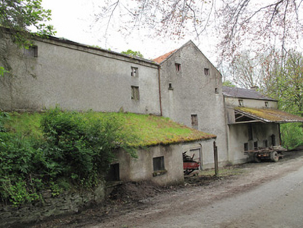 Historic buildingOfficially recorded historic building · 299 yd
Explorer Tom This historic building in Drummullan is a former mill that still holds onto its old machinery like grudges. There was a dance there once where the floorboards actually groaned out of embarrassment. Bring a flask and a story about why you’re really here, because silence is awkward.
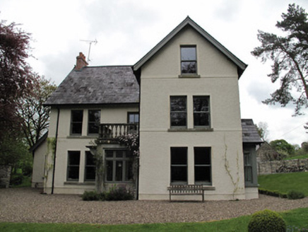 MillviewMill manager's house · 354 ydRoosky Castle (Site of)Castle, ringwork · 997 ydLisarrilly HillMountain / peak · 1713 yd
 Grave YardGraveyard · 1.3 mi
Explorer Tom Killeevan Glebe graveyard is D-shaped because the map makers were drunk one Tuesday afternoon and couldn’t decide on a square. It sits on a ridge, looking slightly confused about its own geometry. Snap one photo, then put the phone away and actually look.
 Common Lime1.8 mi
Explorer Tom This Common Lime in County Monaghan keeps whispering to its younger self about making better leaf choices. It’s got serious regret issues now. If it's closed, admire it from the road like a polite stalker.
Jaundice WellSpring · 1.9 miSaint John's WellSpring · 2.0 mi Abbey RuinsHeritage attraction · 4.0 mi
 Shrine in CrossmoyleShrine · 4.0 mi
Explorer Tom Shrine in Crossmoyle would post 'Just woke up from a thousand-year nap' on social media. It looks like a tiny wooden church carved from sandstone. Bring a jacket, it's never as warm as I promise.
 Ulster Canal Stores Visitor CentreHeritage attraction · 4.2 mi
 European Yew5.9 mi
Explorer Tom A European Yew in Monaghan suspects the postman is stealing its berries just to annoy it personally. It keeps watch from the shadows with intense suspicion. Linger, it's not going anywhere and neither should you.
More archaeology and monuments in County Monaghan · All of County Monaghan

What do you know about this place?Tap to add a comment or ask a question