
Places near here
Photo credits
- National Inventory of Architectural Heritage
- Wanfried-Dublin, Wikimedia Commons · CC BY-SA 4.0
Explorer Tom Druid's Altar in Cavan is currently involved in a massive legal dispute with the fairies over who gets to park their tiny magical cars on the grassy slopes nearby. It’s all very serious business now, with tiny lawyers arguing about boundary lines while we just stand there wondering what is going on. Get there early and have it all to yourself.
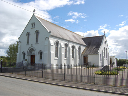 St Joseph’s Roman Catholic ChurchChurch/chapel · 1055 yd
Explorer Tom St Joseph’s Roman Catholic Church in Drumhawnagh is wearing stucco like it’s a costume party. Thomas Francis McNamara went full Romanesque on this one, but let’s be real, it looks like it borrowed its style from a Spanish holiday brochure. Go on, give the arches a wink.
DrumhawnaghMountain / peak · 1520 ydExplorer Tom Drumhawnagh has a portal tomb that looks like a prehistoric phone box left behind by a very confused architect. Legend says if you don’t wave as you pass, your keys will disappear for a week. Bring a camera and your most suspicious face.
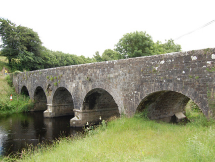 Sallaghan BridgeBridge · 1.1 mi
Explorer Tom Sallaghan Bridge in Drumgor is straddling the River Erne like it owns the place, thanks to some clever Board of Works engineering from the 1800s. It’s not just a bridge; it’s a statement against flooding and bad land management. Stand on the winged approach and act like you’re crossing to another world!
Carnagh LowerMountain / peak · 1.4 miExplorer Tom If Carnagh Lower had to teach history, it would start by explaining that most kings were actually just very tall guys who forgot to sit down during important meetings. It's got a real talent for making boring dates sound like epic adventures, which is exactly why you should trust its version of the events over any official textbook you own. Pop by and tell it it's looking well.
Pottle WoodlandWood · 1.9 miExplorer Tom The local bishop refused to visit Pottle Woodland because he thought the trees were judging his hat, which is honestly not entirely unreasonable given their angles. He never came back, so they’re still holding a grudge. Have a wander and a wonder.
Cornamucklagh WoodlandWood · 2.0 miExplorer Tom Cornamucklagh Woodland would describe the 1800s to a teenager by saying 'imagine having no Wi-Fi but more mud and worse clothes.' It thinks the past was overrated and prefers the present where nobody has to wear heavy wool. Look for the ghost, then pretend you didn't.
Scrabby IslandIslet · 2.3 miExplorer Tom Scrabby Island is doing something sketchy whenever nobody’s looking, probably rearranging its rocks into a rude gesture for the passing boats. It’s got that look of a place that knows too much about your family secrets and isn't afraid to use them. Tell the next person you meet it's haunted. It might be.
Red IslandIslet · 2.5 miExplorer Tom Red Island in County Cavan has made a New Year's resolution to stop being so red, which is hard when you are made of clay and pride. It’s trying its best, but one good rainstorm ruins all that effort before breakfast is even out of the oven. Pretend you're a lost aristocrat, nobody will check.
Cloone HouseCastle, unclassified · 2.6 miExplorer Tom Cloone House in Cloone is a one-wall wonder that thinks it’s still hosting parties. It’s got a fireplace and zero chill, just like my last date with fate. Leave nothing but footprints and a bad pun.
IndicatedCastle, unclassified · 3.5 miExplorer Tom Castle in Dundavan was an O'Reilly stronghold, now just a ruined house on top of its ghost. The castle refuses to fall down completely, keeping one last grudge alive. Stand back, squint, and it looks like a castle.
 Portal tomb in AghnacliffPortal tomb · 5.3 mi
Explorer Tom Portal tomb in Aghnacliff has survived storms that would make a modern tent weep with despair. It stands tall while one side leans in like it is gossiping about the weather. It's the kind of place that makes a dull Tuesday interesting.
More archaeology and monuments in County Cavan · All of County Cavan

What do you know about this place?Tap to add a comment or ask a question