What is recorded here
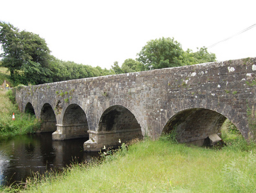
Five-arch stone road bridge, built c.1850, over River Erne. Coursed squared rubble limestone slightly battered piers, abutments, spandrels and barrel. Coursed squared rubble sandstone abutments with chamfered string course at impost level and V-cutwaters. Stepped cut-stone voussoirs to semi-circular arches. Squared rubble stone parapet having dressed angled coping and pyramidal capstones to piers. Squared rubble stone wing walls having curved parapet profile to inner road bend and terminating with pyramidal capstones.
A well executed road bridge over the River Erne of simple expression. The bridge replaces an earlier bridge of multiple arches shown on the Ordnance Survey map of 1836. It is an excellent example of the type of bridge constructed by the Board of Works as part of arterial drainge schemes in the nineteenth century, whereby river channels were narrowed and deepened to reduce flooding and improve the quality of agricultural land. The gentle sweep of the winged approaches gives an understated elegance to the bridge composition. It is built mainly of roughly coursed limestone, embellished with fine cut-stone detailing for the coping stones, string course, and voussoirs which add a level of formality to the bridge. It is a fine example of nineteenth-century bridge construction and makes an important contribution to the architectural character of its landscape setting.
From the Buildings of Ireland (National Inventory of Architectural Heritage) record 40403002
This does not grant access. Most recorded buildings are privately owned; view them only from public ground unless the owner allows entry.
Places near here
Druid's AltarArchaeological place · 1.1 miAghaveansMountain / peak · 1.1 mi Dingins BridgeBridge · 1.1 miPottle WoodlandWood · 1.3 mihandball alley1.4 miCornagranMountain / peak · 1.7 miScrabby IslandIslet · 1.8 miCornamucklagh WoodlandWood · 1.8 miCloone HouseCastle, unclassified · 2.0 miRed IslandIslet · 2.3 miBawn in CastlepolesBawn · 2.8 miPortal tomb in AghnacliffPortal tomb · 4.8 mi
 Dingins BridgeBridge · 1.1 miPottle WoodlandWood · 1.3 mi
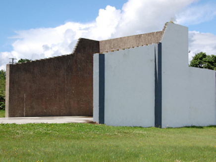 handball alley1.4 miCornagranMountain / peak · 1.7 miScrabby IslandIslet · 1.8 miCornamucklagh WoodlandWood · 1.8 miCloone HouseCastle, unclassified · 2.0 miRed IslandIslet · 2.3 miBawn in CastlepolesBawn · 2.8 mi
 Portal tomb in AghnacliffPortal tomb · 4.8 mi
Pictures: National Inventory of Architectural Heritage; Wanfried-Dublin, Wikimedia Commons · CC BY-SA 4.0
More historic places in County Cavan · All of County Cavan
What do you know about this place?