What is recorded here
Rectangular shaped graveyard (map dims. c. 66m E-W; c. 26m N-S) with church remains (LH010-016001-) indicated on 'OS 6-inch' maps, although no longer visible.
From the National Monuments Service (Archaeological Survey of Ireland) record LH010-016002
Places near here
Photo credits
- Kieran Campbell, Geograph · CC BY-SA 2.0
- National Inventory of Architectural Heritage
- Vicente Fernández Rioja, Wikimedia Commons · CC BY-SA 4.0
- Malene Thyssen, Wikimedia Commons · CC BY-SA 3.0
- Cathar11, Wikimedia Commons · CC0
- Dundalk99, Wikimedia Commons · CC BY-SA 4.0
- Eric Jones, Geograph · CC BY-SA 2.0
- Wanfried-Dublin, Wikimedia Commons · CC BY-SA 4.0
 mill (water)50 yd
 New BridgeBridge · 1436 yd
 Catholic ChapelChurch · 1599 yd
 Monkey-puzzle4.1 mi
 European Beech4.2 mi
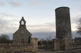 Round Tower4.4 mi
 Mannan Castle (in ruins)Castle, Anglo-Norman masonry castle · 4.8 mi
 Castletown MotteArchaeological place · 9.5 mi
 Ballsmill Amenity LandPicnic place · 9.7 mi
Explorer Tom Ballsmill Amenity Land sits right where Ballsmill Road meets Glasdrumman Road, perfect for a riverside picnic and a chat.
 Dundalk CentralHeritage attraction · 9.8 mi
 Maid of ErinMemorial · 10 mi
 Megalithic StructureWedge tomb · 10 mi
More archaeology and monuments in County Louth · All of County Louth

What do you know about this place?Tap to add a comment or ask a question