
What is recorded here
Adjacent to lake, at NE end of Kilcolman Bog. Indicated on 1842 OS 6-inch map as complex of structures around yard, named 'Dairy': long ranges on NE and SE sides, with shorter structure on NW side. Similar layout on 1906 OS 6-inch map but buildings marker 'in ruins' except NE range. NE range survives as 1-storey, 5-bay, gable-ended residential house. Ruined 1-storey SE range (int: 31m NE-SW; 3.08m NW-SE) has a series of stone arched doors and one wide arch in NW wall. Known locally as 'Hill's Dairy' after the family that once owned the estate. 'Old Dairy', indicated on 1842 OS 6-inch map c. 900m to W, no longer survives.
The above description is derived from the published 'Archaeological Inventory of County Cork. Volume 4: North Cork' (Dublin: Stationery Office, 2000). In certain instances the entries have been revised and updated in the light of recent research.
Date of upload/revision: 14 January 2009
The monument record does not grant public access. Check the route and ask the landowner before entering private land.
- What survives
- Recorded monument
Places near here
 Kilcolman Castle (in Ruins)Castle, tower house · 407 yd
 Kilcolman CastleCastle · 408 yd
 Ballinvonear Schoolschool · 1310 yd
 Templetaggart Church (in Ruins) (193Church · 1376 yd
 Grave YardGraveyard · 1387 yd
 LissardFairy fort / earthen ringfort · 1.2 mi
 Rogan's Rock CovertWood · 1.3 mi
 Brough WoodWood · 1.6 mi
 Smith's WellSpring · 1.9 mi
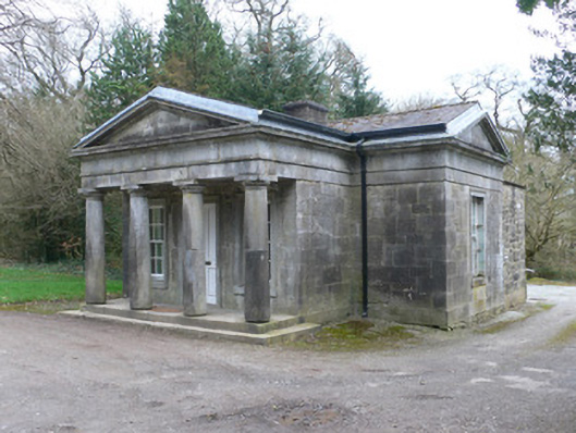 Doneraile Courtgate lodge · 2.3 mi
 Doneraile HouseHeritage attraction · 2.6 mi
 David HurleyMemorial · 2.8 mi
Other information
Photo: Credit not shown in the picture search · Rights wording not checked; contact us if this picture should be removed