DDiscover AloneMapAbout

Castle in Garranbane

Castle, unclassified

The monument record does not grant public access. Check the route and ask the landowner before entering private land.

What do you know about this place?Tap to add a comment or ask a question

What you write will be public.

What is recorded here

The remains of a possible bawn wall belonging to Cappercullen Castle can be seen standing on the SE edge of a steep river valley with site of levelled Cappercullen House located 40m to W. Modern tennis courts now stand on the site of the levelled Cappercullen House. The wall which is visible today survives in the SE…

Read the whole record
The remains of a possible bawn wall belonging to Cappercullen Castle can be seen standing on the SE edge of a steep river valley with site of levelled Cappercullen House located 40m to W. Modern tennis courts now stand on the site of the levelled Cappercullen House. The wall which is visible today survives in the SE wall of the garden of Cappercullen House overlooking Cappercullen Glen immediately to SE. The wall has a clear batter visible on SE face only with alternating quoins visible on the angle, the lower wall footings of the SW wall (wall T 0.85m; H 0.5m) return survive. There is no batter visible on the SW wall return. The batter on the SE wall appears to have been built in order to support the masonry facing of the steep slope into which it is built. This sloping wall could be the remains of a bawn wall running parallel to the valley with the site of the levelled castle located on flat ground to the N in the area where a cottage stands today. The upstanding wall acts as a retaining wall for the garden where it has been built into the steep NW facing slope overlooking Cappercullen Glen. This wall belongs to a building depicted on the 1840 ed. OS 6-inch map which is shown as a narrow rectangular building aligned NNE-SSW running parallel to the steep river valley immediately to SE. On the OS 6-inch map it is depicted as one of several outbuildings associated with Cappercullen House. The quoin stones used in the construction the garden sheds of the walled garden located to W may have been reused from the medieval castle. Some of the quoins on the SW angle of the garden shed built up against the external face of the SE wall of the walled garden have a chamfered surface which may suggest that they came from the medieval castle. In 1569 Henry Mac Lysagh Omulrian, of Cappercullen was granted a royal pardon (Westropp 1906-07, 100). In 1604 Theobald Baron Bourgh, of Castleconnell was granted the castle and lands of Cappercullen which was formerly part of the estate of 'Conogher, mac Edmund, mac Lysagh, O'Mulrian' (ibid.). The castle of 'Capacullyn' is depicted on the 1656 Down Survey map of Abbeyowneybeg barony (Hib. Reg.). The terrier of the Down Survey parish map of Abbeyowneybeg stated that in this parish there was at Cappercullen 'A Castle two Thatched House and some Cabbins' (ibid.) On this map the castle is depicted as a tower house type structure standing on a low rise of ground with battlemented parapet. In 1641 Colonel Pierce Walsh of Abbeyowney was listed as the proprietor of the lands of 'Cappacullyn' which consisted of 261 acres of profitable land and 33 acres of bog (ibid.). The 1654-56 Civil Survey of Limerick recorded that Piers Walsh was the owner of 230 acres of land in 'Keapacnillin' (Cappercullen) 'with a Castle thereunto' (Simington 1938, 4). In 1667 the forfeited castle and lands of Cappercullen were granted to George Evans (Westropp 1906-07, 100). Around 1680 a walled garden was built to the W of the medieval castle (Murphy 2014, 19). Cappercullen House was built by Lord Carbery in the early 18th century (ibid., 21). Modern tennis courts now stand on the site of the levelled 18th century house.

From the National Monuments Service (Archaeological Survey of Ireland) record LI007-010001

Places near here

Photo credits
  • The Banner, Wikimedia Commons · CC BY-SA 3.0
  • National Inventory of Architectural Heritage
  • Antony Dixon, Wikimedia Commons · CC BY-SA 2.0
  • Garry Dickinson, Geograph · CC BY-SA 2.0
  • SirGarick, Wikimedia Commons · CC BY-SA 4.0
  • Andreas F. Borchert, Wikimedia Commons · CC BY-SA 4.0
  • No machine-readable author provided. Christian1965~commonswiki assumed (based on copyright claims)., Wikimedia Commons · Public domain
  • Hywel Williams, Geograph · Creative Commons Attribution-ShareAlike 2.0
  • Colin Park, Geograph · CC BY-SA 2.0
Glenstal AbbeyCountry house · 245 ydMoroe Muintir na Tíre HallCommunity centre · 1245 yd

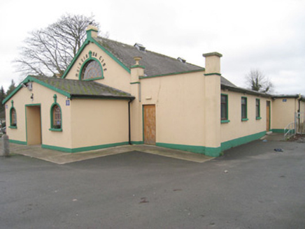
Explorer Tom Moroe Muintir na Tíre Hall was built on a bargain where the contractor got paid in gossip and stone. The Diocletian window is actually a giant eye watching everyone who dances badly inside. Ideal spot for a dramatic phone call to Mum.
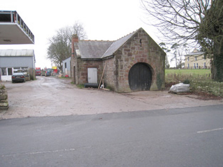
forge/smithy1295 yd

Explorer Tom The Forge in Moroe has a door shaped exactly like a horse shoe, which is peak confidence. A fake royal visit happened here once, allegedly, but nobody can prove it. Get there early before the ghosts get their coffee.
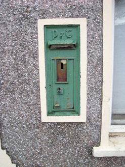
post box1371 ydCatholic Church of the Holy RosaryChurch/chapel · 1478 yd

Explorer Tom Catholic Church of the Holy Rosary in Liscreagh cost seven thousand pounds back in 1904, which is a lot of money for stone. It uses red sandstone and limestone in a way that’s just plain gorgeous to look at. Bring sandwiches, because the drive out here will make you hungry.

Slieve FelimMountain / peak · 3.5 miCastleCastle, motte and bailey · 4.0 mi

Explorer Tom The motte at Brittas is losing a rivalry with a more famous place because it got levelled by a farmer. Sit on a wall near it and pretend you're in a painting; nobody will mind if you drop your hat.

Castle ConnellRuins · 5.8 miCath.Cathedral · 10 mi

Explorer Tom Cathedral in Shantraud is hiding its light under a very large bushel of mystery. The locals probably think the roof leaks because they forgot to pay the celestial plumber. It’s a proper spot for a flask of tea and a big, confused think about history.

Áine and Gearóid Iarla: Lough GurLegend location · 11 mi

Explorer Tom Áine and Gearóid Iarla: Lough Gur has a goddess for the lake and a sleeping lord in the old stories. I thought I was coming to admire water and stones. Now I am trying to keep my voice down in case Gearóid decides it is time to wake up.

Grave YardGraveyard · 19 miSlievereaghMountain / peak · 20 mi

More castles and forts in County Limerick · All of County Limerick

Add to this placeAdd a picture Add a detailed tip Add a story

Explore the map1,093,392 places to discover

Next place · or swipeGlenstal Abbey