What is recorded here
An earlier report (OPW 1974) described an almost circular raised area (int. diam. c. 50m) enclosed by a substantial earthen bank and slight traces of a fosse. Original entrance position was not identifiable. Site has been levelled. Not visible at ground level.
From the National Monuments Service (Archaeological Survey of Ireland) record CV030-019
The monument record does not grant public access. Check the route and ask the landowner before entering private land.
- What survives
- Recorded monument
Places near here
Gartylough Wet WoodlandWood · 1062 yd Saint Mary's Catholic ChurchChurch/chapel · 1125 ydHill HouseHouse · 1152 ydEnclosureEnclosure, large enclosure · 1324 ydCastlepolesMountain / peak · 1714 ydBawn in CastlepolesBawn · 1.2 miCorlisbrattanMountain / peak · 2.1 miCastleBawn · 2.1 miWhite IslandIslet · 2.6 miScrabby IslandIslet · 3.6 miEuropean Yew4.9 miPortal tomb in AghnacliffPortal tomb · 5.1 mi
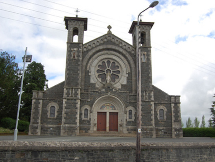 Saint Mary's Catholic ChurchChurch/chapel · 1125 yd
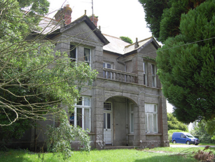 Hill HouseHouse · 1152 ydEnclosureEnclosure, large enclosure · 1324 ydCastlepolesMountain / peak · 1714 ydBawn in CastlepolesBawn · 1.2 miCorlisbrattanMountain / peak · 2.1 miCastleBawn · 2.1 miWhite IslandIslet · 2.6 miScrabby IslandIslet · 3.6 mi
 European Yew4.9 mi
 Portal tomb in AghnacliffPortal tomb · 5.1 mi
Pictures: National Inventory of Architectural Heritage; Sitomon, Wikimedia Commons · CC BY-SA 2.0; Wanfried-Dublin, Wikimedia Commons · CC BY-SA 4.0
More archaeology and monuments in County Cavan · All of County Cavan
What do you know about this place?