What is recorded here
Large subcircular raised area (int. dims. 83m N-S; 68m E-W) enclosed by an earthen bank best preserved from SW-N-NNE, and a fosse well-defined from NW-N-SSW only. Both bank and fosse have been disturbed by quarrying. Depression in bank with accompanying causeway at ESE may represent original entrance. Within the interior at S is a short segment of earthen bank extending 5m N from the enclosing bank. Situated at the foot of a high drumlin hill.
Large subcircular raised area (int. dims. 83m N-S; 68m E-W) enclosed by an earthen bank best preserved from SW-N-NNE, and a fosse well-defined from NW-N-SSW only. Both bank and fosse have been disturbed by quarrying. Depression in bank with accompanying causeway at ESE may represent original entrance. Within the interior at S is a short segment of earthen bank extending 5m N from the enclosing bank. Situated at…
From the National Monuments Service (Archaeological Survey of Ireland) record CV024-057
The monument record does not grant public access. Check the route and ask the landowner before entering private land.
- What survives
- Recorded monument
Places near here
IndicatedFairy fort / earthen ringfort · 1324 yd Hill HouseHouse · 1430 ydSaint Mary's Catholic ChurchChurch/chapel · 1453 ydCastlepolesMountain / peak · 1.1 miBawn in CastlepolesBawn · 1.3 miCorlisbrattanMountain / peak · 1.5 miPortal tomb in BirrinaghPortal tomb · 2.4 miCastleBawn · 2.8 miCornafean gfcMemorial · 3.2 miWhite IslandIslet · 3.4 miEuropean Yew4.4 miCommon Lime5.0 mi
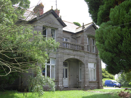 Hill HouseHouse · 1430 yd
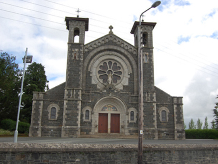 Saint Mary's Catholic ChurchChurch/chapel · 1453 ydCastlepolesMountain / peak · 1.1 miBawn in CastlepolesBawn · 1.3 miCorlisbrattanMountain / peak · 1.5 miPortal tomb in BirrinaghPortal tomb · 2.4 miCastleBawn · 2.8 miCornafean gfcMemorial · 3.2 miWhite IslandIslet · 3.4 mi
 European Yew4.4 mi
 Common Lime5.0 mi
Pictures: National Inventory of Architectural Heritage; Sitomon, Wikimedia Commons · CC BY-SA 2.0; Alvesgaspar, Wikimedia Commons · CC BY-SA 3.0
More archaeology and monuments in County Cavan · All of County Cavan
What do you know about this place?