
Places near here
Photo credits
- National Inventory of Architectural Heritage
- Malene Thyssen, Wikimedia Commons · CC BY-SA 3.0
- Allie_Caulfield from Germany, Wikimedia Commons · CC BY 2.0
- Kenneth Allen, Geograph · CC BY-SA 2.0
- Andreas F. Borchert, Wikimedia Commons · CC BY-SA 4.0
- Simonchadwick1023, Wikimedia Commons · CC BY-SA 4.0
Explorer Tom Lattacrossan has developed a profound suspicion of the postman and refuses to let any letters get through to its base camp. It’s basically guarding the mail from underneath there, convinced that every envelope contains a bill it didn’t order or a recipe for soup. Dare you to say hello to it out loud.
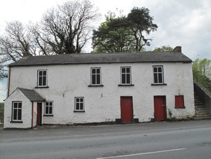 Scotshouse National SchoolSchool · 1043 yd
Explorer Tom Scotshouse National School has a legend about a giant who got stuck in the doorway and never left. It’s just a building, but the story feels realer than school trips. Tell the next person you saw him blinking.
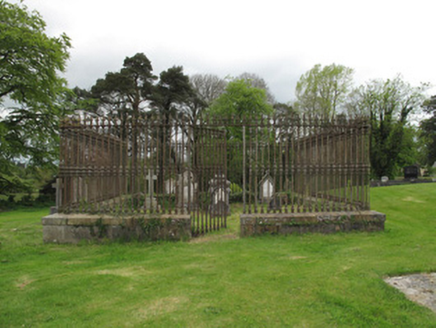 Saint Andrew's Church (Currin)Grave monument · 1078 yd
Explorer Tom Saint Andrew's Church in Currin handles nosy neighbours by just staring at them until they get embarrassed and leave. Two brothers died close together and got this fancy bronze soldier treatment, which is quite the display of wealth. Have a chat with it about its family history over there.
CallowhillMountain / peak · 1.2 miExplorer Tom Callowhill in County Monaghan gave up its rocky outcrops for Lent, which is a pretty solid sacrifice if you ask me. I reckon it spent the whole forty days just sitting there looking smug about being slightly less pebbly than usual. Now it’s back to its normal self, probably waiting for someone to compliment its new minimalist aesthetic. Go with someone who loves old stuff and watch them melt.
 European Beech1.2 mi
Explorer Tom Another European Beech here remembers the day a goat tried to climb it and failed spectacularly. The whole valley saw the disaster unfold. Tell it a joke, it's been a long time since anyone did.
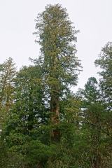 Coast Redwood1.5 mi
Explorer Tom Coast Redwood in County Monaghan is having a massive row with the village over who stole its shadow. It’s pretending to be ancient, but it’s just showing off. Bring your own legend, I’ve run out.
Drumcarn HouseCastle, unclassified · 3.1 miExplorer Tom Drumcarn House in Drumcarn does the cha-cha when nobody’s looking, just to keep its foundations flexible and young. It’s hidden under a farmyard, acting all mysterious like it knows something you don’t. If it rains, blame me.
CastleCastle, unclassified · 4.2 miExplorer Tom Lislin Castle has been levelled so much it's basically a very confident hill. It probably orders extra ketchup at the chippy to compensate for its lack of height. Look for the ghost, then pretend you didn't.
 Ulster Canal Stores Visitor CentreHeritage attraction · 4.4 mi
Explorer Tom Ulster Canal Stores Visitor Centre in Monaghan has made its New Year's resolution to stop leaking water into the display cases, but we all know it won't hold up. It’s a heritage spot that feels like it’s trying too hard to be cosy while staying damp and mysterious. Have a nosey, politely.
 Shrine in CrossmoyleShrine · 4.5 mi
Explorer Tom Shrine in Crossmoyle would post 'Just woke up from a thousand-year nap' on social media. It looks like a tiny wooden church carved from sandstone. Bring a jacket, it's never as warm as I promise.
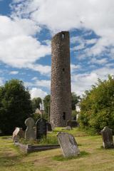 Round Tower4.5 mi
Explorer Tom Round Tower in Crossmoyle stands there looking all serious, built back when people liked their architecture simple and their doors low. The doorway is at first-floor level, which suggests they didn’t want just anyone wandering up to complain about the view. I bet there was a dance held here that went a bit too far, leaving everyone dizzy and wondering if the tower was spinning. Bring biscuits
 Abbey RuinsHeritage attraction · 4.5 mi
Explorer Tom Abbey Ruins in County Monaghan would post a selfie with a filter on, captioning it 'Vibes only' while ignoring its crumbling walls. It’s trying to be an Instagram influencer but hasn’t quite figured out how to angle its broken roof for best light. Look serious, nod slowly, you're basically an expert now.
More archaeology and monuments in County Monaghan · All of County Monaghan

What do you know about this place?Tap to add a comment or ask a question