What is recorded here
Marked on Petty's Survey map of 1685 and recorded as being part of the lands of one Hugh Brady at that time. Foundations of a house, reputedly built by the Saundersons, marked on 1836 ed. Described (Davies 1948a, 120) as comprising 'fragments of mortared walls' situated in a hollow. Site now largely covered by modern farmyard, leaving no visible remains at ground level.
From the National Monuments Service (Archaeological Survey of Ireland) record CV016-048
The monument record does not grant public access. Check the route and ask the landowner before entering private land.
- What survives
- Recorded monument
Places near here
Ceremonial enclosure in NeddaiaghCeremonial enclosure · 1332 ydArdamaghMountain / peak · 1.3 miCastleCastle, unclassified · 1.3 mi St Mary's Roman Catholic ChurchChurch/chapel · 1.4 miCorrakeeranMountain / peak · 1.5 miBallynallon BridgeBridge · 1.6 miGarden IsleIslet · 2.3 miGiant's GraveArchaeological place · 2.9 miEuropean Yew3.0 miSycamore3.1 miFin Mc Cools FingersStone row · 3.8 miCastle SaundersonCastle, unclassified · 5.6 mi
 St Mary's Roman Catholic ChurchChurch/chapel · 1.4 miCorrakeeranMountain / peak · 1.5 mi
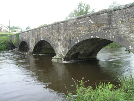 Ballynallon BridgeBridge · 1.6 miGarden IsleIslet · 2.3 miGiant's GraveArchaeological place · 2.9 mi
 European Yew3.0 mi
 Sycamore3.1 mi
 Fin Mc Cools FingersStone row · 3.8 mi
 Castle SaundersonCastle, unclassified · 5.6 mi
Pictures: Deadstar, Wikimedia Commons · CC BY-SA 4.0; National Inventory of Architectural Heritage; Sitomon, Wikimedia Commons · CC BY-SA 2.0; Christian Pirkl, Wikimedia Commons · CC BY-SA 3.0 at; Mike Searle, Geograph · CC BY-SA 2.0
More castles and forts in County Cavan · All of County Cavan
What do you know about this place?