
Places near here
Photo credits
- Kieran Campbell, Geograph · CC BY-SA 2.0
- National Inventory of Architectural Heritage
- Mike Searle, Geograph · CC BY-SA 2.0
- Britishfinance, Wikimedia Commons · CC BY-SA 4.0
- Deadstar, Wikimedia Commons · CC BY-SA 4.0
- Mike Searle, Wikimedia Commons · CC BY-SA 2.0
- Sitomon, Wikimedia Commons · CC BY-SA 2.0
- Alvesgaspar, Wikimedia Commons · CC BY-SA 3.0
- Bill Griffiths, Wikimedia Commons · CC BY-SA 2.0
 CastleCastle, motte and bailey · 1.4 mi
Explorer Tom Castle in Castlecor started as a bet between two lads in the pub about who could build the biggest dirt pile. They won, then forgot to mention it had trees growing out of it. Tell the kids it's a castle. Close enough.
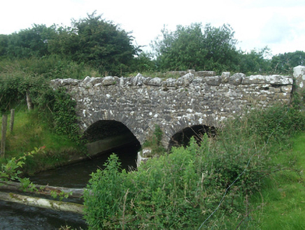 Ballinacree BridgeBridge · 1.6 mi
Explorer Tom Ballinacree Bridge's name really means 'Bally the Creeper,' a giant slug who used to live under it before he moved to the sea. The rough stone arches are just his old fingerprints left behind from when he was stretching out after a long nap on the Cavan-Meath border line.
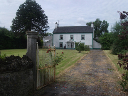 Lisnabrin HouseFarm house · 1.8 mi
Explorer Tom Lisnabrin House is all classic symmetry and sash windows, looking very serious near Mountnugent. It probably charges entry just to look at it. Go on, count your coins before you even knock on that door.
 Fairy fort / earthen ringfort in Garrysallagh (o'reilly)Fairy fort / earthen ringfort · 1.9 mi
Explorer Tom Fairy fort / earthern ringfort in Garrysallagh has three banks and a causeway at the east, plus some stone foundations that might be a hut or just rocks. It’s definitely winning the 'most complicated dirt circle' prize. Bring a camera and your most suspicious face.
Fennor LowerMountain / peak · 2.3 miExplorer Tom Fennor Lower in County Meath has an imaginary twin across the sea that sends it postcards about how much better its weather is, but we both know that’s a complete lie. It’s just a hill pretending to be something more exotic because it got tired of being called 'Lower'. Tell the kids it's a castle. Close enough.
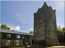 Ross CastleCastle, tower house · 2.9 mi
Explorer Tom Ross Castle is where a dance was held that went so far they forgot how to stop, and no one has recovered since. You’ve got a four-storey tower that’s been restored from ruins, which is basically a skeleton in a very expensive suit. It’s definitely not going to let you touch the curtains without asking permission first. Visit, then text me what you think. I'll pretend to read it.
 Mullaghmeen ForestPicnic place · 3.9 mi
Explorer Tom Mullaghmeen Forest’s name basically means “The Hill Where The Sheep Went To Die” if you squint really hard at the map. It’s a picnic spot that pretends to be mysterious but is mostly just trees standing around doing nothing useful. Bring a pen pal, they'll be jealous.
 Sheela-na-gig (present location) in Kilmore (castlerahan By., Ballyjamesduff Ed)Sheela-na-gig (present location) · 5.0 mi
Explorer Tom Sheela-na-gig in Kilmore was found in a medieval church and now lives in a museum, looking utterly unbothered by it all. She's seen some things, and she doesn't care what you think. Bring a camera and your most suspicious face.
 Loughcrew GardensGarden · 5.3 mi
Explorer Tom Loughcrew Gardens in County Meath would tell teenagers that the 1800s were basically just everyone wearing corsets and complaining about the rain. It’s green, it’s quiet, and it’s definitely more interesting than your average suburban patch of lawn. Count the crows sitting on the fence, then count them again to be sure.
 European Yew5.3 mi
Explorer Tom European Yew in County Meath witnessed a love story that went horribly wrong right next to its trunk. The poor tree is still flinching from the drama. It's free, it's odd, what more do you want?
 Common Lime5.3 mi
Explorer Tom Common Lime in County Meath would teach history by dropping leaves on your head until you memorised the dates. It’s got more patience than most teachers and twice the attitude. Pop by and tell it it's looking well.
 Slieve Na CalliaghMountain / peak · 5.7 mi
Explorer Tom Slieve na Calliagh is Meath's highest hill at 276 metres, but its real claim is the crowd of ancient tombs along the tops. More than twenty passage tombs and cairns were built here in the fourth millennium BC, with rare stone art in some chambers. Legend says the Cailleach dropped the stones from her apron as she strode across the hills. I would try that trick, but my apron barely holds lunch. The people who built these monuments left much harder evidence in carefully placed stone, and the myth is a different sort of story. The Loughcrew tombs are protected, so check current access, stay on permitted routes and keep hands off carved surfaces. The hills include Carnbane East and West, not just one neat summit. Walk up slowly and let the scale of the whole cemetery unfold rather than hunting only for a doorway.
More archaeology and monuments in County Cavan · All of County Cavan

What do you know about this place?Tap to add a comment or ask a question