
Places near here
Photo credits
- National Inventory of Architectural Heritage
- Mac McCarron, Geograph · Creative Commons Attribution-ShareAlike 2.0
- John M, Geograph · CC BY-SA 2.0
- Peter Craine, Wikimedia Commons · CC BY-SA 2.0
- Colin Park, Geograph · CC BY-SA 2.0
 Scoil Mhuire DraighneaghSchool · 2.1 mi
Explorer Tom Scoil Mhuire Draighneagh is a classic 1960s State school design, which means it probably smells faintly of chalk dust…
 Sacred Heart Roman Catholic ChurchChurch/chapel · 2.1 mi
Explorer Tom Sacred Heart Roman Catholic Church in Paddock was built in 1932 with fish-scale slate bands. It’s got a cruciform plan…
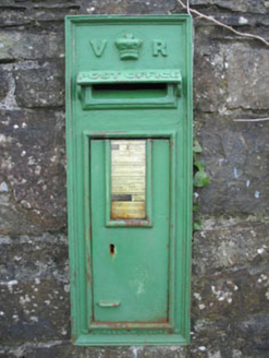 post box3.9 mi
Explorer Tom Post box in Derreeny has a Queen Victoria monogram and crown motif set into a rubble stone wall from 1890. It’s a…
 Derreeney BridgeBridge · 3.9 mi
Explorer Tom Derreeney Bridge: This fine bridge is showing off its skilled craftsmanship like it built the Taj Mahal. Locals swear a…
 Derreeney HouseCountry house · 3.9 mi
Explorer Tom Derreeney House is a classic nineteenth-century middle-class flex with a well-balanced façade that refuses to let go of…
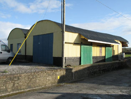 railway station4.1 mi
Explorer Tom Railway station in Derreeny is actually just some outbuildings now, but it was a station in 1877. The corrugated iron…
 HollybrookGate lodge · 5.4 mi
Explorer Tom Hollybrook in Maulbrack is a gate lodge that thinks it's the main event of West Cork. It's Arts and Crafts style, which…
 Grove HouseCountry house · 5.5 mi
Explorer Tom Grove House in Coolnagarrane has turned itself into a guesthouse, which is wild. It’s got camber-headed windows that…
 Garinish WestIslet · 17 mi
Explorer Tom Garinish West was once offered to a cow who wanted to buy it with a very shiny hoof, but the paperwork got lost in a…
 Glengarriff WoodsWood · 18 mi
Explorer Tom Glengarriff Woods has old oaks that survived a spell when people thought the answer to every forestry question was…
 Gowlbeg MountainMountain / peak · 18 mi
Explorer Tom Gowlbeg Mountain is getting some serious heat from the local seagulls who think it’s hogging all the good wind. They’ve…
 Sugarloaf MountainMountain / peak · 19 mi
Explorer Tom Sugarloaf Mountain above Glengarriff is Cork's answer to anyone who thinks a mountain should come with a neat little…
More archaeology and monuments in County Cork · All of County Cork

What do you know about this place?Tap to add a comment or ask a question