
Places near here
Photo credits
- National Inventory of Architectural Heritage
- Picturesque Views of the Antiquities of Ireland (1830); artist unrecorded, Wikimedia Commons · Public domain
- This file is from the Mechanical Curator collection , a set of over 1 million images scanned from out-of-copyright books and released to Flickr Commons by the British Library. View image on Flickr View all images from book View catalogue entry for book ., Wikimedia Commons · Public domain
- Wikimedia Commons contributor · Public domain
- Peter Gerken, Wikimedia Commons · CC BY-SA 2.0
- Sitomon, Wikimedia Commons · CC BY-SA 2.0
 Saint James's Church (Nantinan)Church/chapel · 340 yd
Explorer Tom Saint James's Church (Nantinan) claims its name means 'the place where James tripped and fell', which is definitely true. The pinnacles are sharp enough to slice your pride if you’re not careful. Stand on the spot where the vicar used to slip.
Grave YardGraveyard · 340 ydExplorer Tom Graveyard in Nantinan would tell you about a priest who lost his bet after three pints. The wall is solid stone, but the gossip inside is pure liquid gold. Visit, then text me what you think. I'll pretend to read it.
St. James WellHoly well · 429 ydExplorer Tom St. James Well in Ardgoul South in Limerick is a stone-walled spring that looks like it’s taking a permanent nap. A bishop once refused to visit because he was afraid of the mud. A proper spot for a flask of tea and a big think.
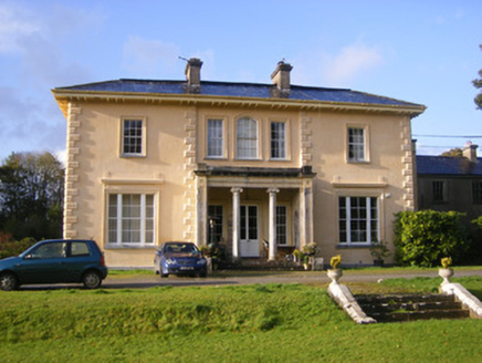 Nantinan HouseCountry house · 574 yd
 Cappagh Castle (in ruins)Castle, tower house · 2.1 mi
Explorer Tom Cappagh Castle is sick of being asked why only one wall is left standing; it says the others just quit. It’s basically a very tall, lonely slice of history sitting on a rock. Visit, then text me what you think. I'll pretend to read it.
 Cappagh CastleCastle · 2.1 miFlat cemetery in CroaghFlat cemetery · 2.9 mi
Explorer Tom Flat cemetery in Croagh smells like ancient ash and pure mystery, according to my very scientific nose. A pipeline dug up one little pit, so it’s basically a gas leak with history. Bring a map, get lost anyway, that's the fun.
 Askeaton CastleHeritage attraction · 2.9 miTobernablahySpring · 3.3 miSt. Kieran's WellSpring · 4.1 mi
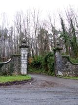 Curraghchase Forest ParkForest · 4.1 mi
 European Yew4.4 mi
Explorer Tom European Yew in County Limerick would have made Saint Patrick blush with its ancient, stoic attitude. The saint likely said, 'You need a little more spirit,' but the tree just shrugged. Bring curiosity, leave with a better story than mine.
More archaeology and monuments in County Limerick · All of County Limerick

What do you know about this place?Tap to add a comment or ask a question