Places near here
Photo credits
- National Inventory of Architectural Heritage
- Granard Motte.png : Smcq Derivative work: Hogweard, Wikimedia Commons · CC BY-SA 3.0
- 2ManyCats4Me, Wikimedia Commons · CC0
Explorer Tom Enclosure in Knockanbaun Or Whitehill has a family tree written on the wind, mostly made up by drunk poets. It’s a…
BarrowBarrow, ring-barrow · 1179 ydExplorer Tom Barrow in Knockanbaun is showing off its fancy double-ring design like it’s the only one on the hill. It posts photos…
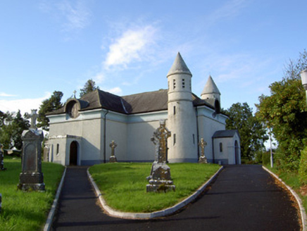 Saint James's Catholic ChurchChurch/chapel · 1450 yd
Explorer Tom Saint James's Catholic Church in Drummeel has more names than a soap opera character and twice as many towers. It was…
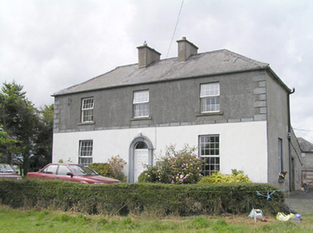 Firmount HouseSteward's house · 1528 yd
Explorer Tom Firmount House in Firmount is wearing its best render like it's going to a gala. It thinks its favourite song is 'Can…
RuinsCastle, unclassified · 1.1 miExplorer Tom Ruins in Lissard had a feud with the next village over whose goat was uglier. Coad described it as ivy-covered in 1832…
Clonfin Ambush MemorialMemorial · 2.1 miExplorer Tom Clonfin Ambush Memorial in Longford is secretly proud of the one potato that survived the battle unscathed, hidden…
Ballinalee Forest WalkForest · 2.6 miExplorer Tom Ballinalee Forest Walk is a small Longford escape with a useful trick up its sleeve: it slips through forestry and…
Cloonfin WoodForest · 2.9 miExplorer Tom Cloonfin Wood is where locals say you have to walk backwards if you want the trees to tell you your future, which…
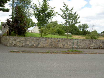 Bully's AcreGraveyard/cemetery, unknown · 3.0 mi
Explorer Tom Bully's Acre in Ballinalee is a graveyard where rabbits think they own the place, but really it holds the rebels from…
 Moat of GranardCastle, motte and bailey · 5.5 mi
Explorer Tom The local sheep at Granard Moat rate it a solid four stars for grass quality. Richard de Tuit built it in 1199 to fight…
 Granard MotteMotte-and-bailey castle remains · 5.5 mi
Explorer Tom Granard Motte would describe the 1800s to a teenager as 'basically a long queue for nothing'. It's just a big mound…
 1798 MonumentMonument · 5.6 mi
Explorer Tom The 1798 Monument in Granard uses a Celtic high cross style to tell you about a battle that happened two hundred years…
More archaeology and monuments in County Longford · All of County Longford

What do you know about this place?Tap to add a comment or ask a question