
Places near here
Photo credits
- National Inventory of Architectural Heritage
- Jonathan Thacker, Geograph · CC BY-SA 2.0
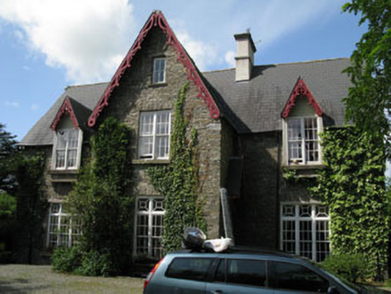 Kilcolman ParkHouse · 1.2 mi
Explorer Tom Kilcolman Park is wearing Tudor Revival bargeboards like a fancy hat it can’t take off. It’s got ruinous outbuildings…
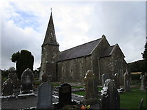 St John's Church of Ireland ChurchChurch/chapel · 1.3 mi
Explorer Tom St John's Church in Killowen has a spire that’s imposing enough to make the weather jealous. It was designed by Joseph…
 Mawbeg BridgeBridge · 1.3 mi
Explorer Tom Mawbeg Bridge in Mawbeg East is a simple rural bridge built by craftsmen who knew their stuff and didn’t need your…
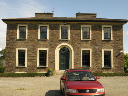 Kilcolman RectoryRectory/glebe/vicarage/curate's house · 1.3 mi
Explorer Tom Kilcolman Rectory was built to show off how rich the Church used to be. It’s got five bays of pure ego and fine grounds…
 Mawmore HouseCountry house · 1.4 mi
Explorer Tom Mawmore House has an elaborately designed doorcase with a fanlight that looks like it’s about to take off into the sky.…
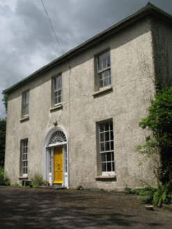 Mawbeg HouseHouse · 1.4 mi
Explorer Tom Mawbeg House is perched up high like it's trying to fly away from the mundane. The fanlight over the door is fancy…
 farm house1.5 mi
Explorer Tom Farm house in Knocknastooka is disused and looking a bit rough around the edges since 1840. It’s got a later lean-to…
 Lady Chapel Roman Catholic ChurchChurch/chapel · 1.5 mi
Explorer Tom Lady Chapel Roman Catholic Church is dressed up in stained glass like it’s ready for a wedding. It’s got a bell tower…
 milestone/milepost1.5 mi
Explorer Tom Milestone or milepost in Gaggan is a simple triangular cast-iron marker from around 1890. It’s got embossed…
 Kilrush HouseHouse · 1.6 mi
Explorer Tom Kilrush House in Kilrush had a dramatic incident where a chimney pot fell and landed exactly on a parked car, but…
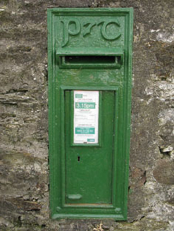 post box1.6 mi
Explorer Tom The Post box in Derrycool is all cast-iron swagger with some fancy Gaelic lettering. It refuses to fall down because it…
 Gaggin HouseFarm house · 1.6 mi
Explorer Tom Gaggin House in Curravarahane is a simple farmhouse from 1860 that’s currently unoccupied, so it’s probably full of…
More archaeology and monuments in County Cork · All of County Cork

What do you know about this place?Tap to add a comment or ask a question