
What is recorded here
From the National Monuments Service (Archaeological Survey of Ireland) record KK021-012
Places near here
Photo credits
- National Inventory of Architectural Heritage
- Mike Searle, Geograph · CC BY-SA 2.0
- Maker not stated on source page, www.visitgalway.ie
- Maker not stated on source page, ru.pinterest.com
- Maker not stated on source page, commons.wikimedia.org
- Maker not stated on source page, en.wikipedia.org
- Maker not stated on source page, www.gettyimages.no
 farm house408 yd
Explorer Tom Farm house in Bohernastrekaun had an escape plan involving a goat and a ladder that never quite worked out as intended.…
 Paulstown CastleCountry house · 846 yd
Explorer Tom Paulstown Castle in Paulstown is named after a guy who probably didn’t even exist, but we’re sticking with it. It’s…
 CastleCastle, tower house · 847 yd
Explorer Tom Castle in Paulstown is run by a dog who knows more about history than any guidebook. The Butlers built it, but the dogs…
 Castlekelly Castle (site of)Archaeological place · 1297 yd
Explorer Tom Castlekelly Castle in County Kilkenny is planning its retirement by slowly turning into a nice-looking pile of rocks.…
 Duninga GraveyardCemetery · 1339 yd
Explorer Tom Duniga Graveyard is currently being evaluated by a colony of rabbits who think the headstones are excellent scratching…
 Barraghcore BridgeBridge · 1415 yd
Explorer Tom Barraghcore Bridge hosted a love story that ended with a broken heart and a wet shoe. It spans the Acore River looking…
 Monefelim BridgeBridge · 1525 yd
Explorer Tom Monefelim Bridge would teach history lessons if it could talk, mostly about how hard it is to stay put when water…
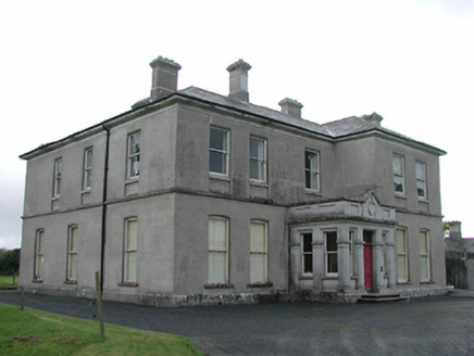 View MountCountry house · 1648 yd
Explorer Tom View Mount would be an absolute disaster on a reality show because everyone would argue about who gets to stand in the…
 Garryduff HouseRectory/glebe/vicarage/curate's house · 1.0 mi
Explorer Tom Garryduff House in Garryduff is sitting pretty on those rolling hills, likely plotting something with the foxes who…
 Kilmacahill GraveyardCemetery · 1.6 mi
Explorer Tom Kilmacahill Graveyard hears the neighbours arguing about football every night through its walls, which is driving it…
 Ogham stone in GowranOgham stone · 2.7 mi
Explorer Tom Ogham stone in Gowran is an old rock with scratches on it that everyone pretends they can read but actually can’t. Map…
 Gowran AbbeyVisitor attraction · 2.7 mi
Explorer Tom Gowran Abbey insists it took exactly three thousand cups of tea to build, which is why the monks were always so jolly…
More archaeology and monuments in County Kilkenny · All of County Kilkenny

What do you know about this place?Tap to add a comment or ask a question