
What is recorded here
From the National Monuments Service (Archaeological Survey of Ireland) record TS068-048001
Places near here
Photo credits
- National Inventory of Architectural Heritage
- Jschroeder85, Wikimedia Commons · CC BY-SA 3.0
- Garry Dickinson, Geograph · CC BY-SA 2.0
- Kurt Stüber [1], Wikimedia Commons · CC BY-SA 3.0
- Mike Searle, Wikimedia Commons · CC BY-SA 2.0
- Sarah777, transferred by Lvova, Wikimedia Commons · Public domain
- Algirdas at Lithuanian Wikipedia, Wikimedia Commons · Public domain
- Deemaykay, Wikimedia Commons · CC BY-SA 4.0
- Colin Park, Geograph · CC BY-SA 2.0
- Graham Horn, Wikimedia Commons · CC BY-SA 2.0
- kevin higgins, Geograph · CC BY-SA 2.0
 Suircastle HouseHouse · 529 yd
Explorer Tom Suircastle House has an entrance that curves in like it's winking at you. The outbuilding next door has a roofline with crenellations, making it look like a tiny castle guarding a very serious shed. Wink back if you dare.
 New BridgeBridge · 1304 yd
Explorer Tom New Bridge in Ballyslatteen has a humpback and an ego to match the heavy walls holding it up. It would be the life of any party, juggling elegant arches while showing off its stonework. Don't let your head hit the top on the way in.
 Athassel PrioryHeritage attraction · 1.1 mi
Explorer Tom Athassel Priory in County Tipperary would tell the modern building that replaced it that it’s all flash and no actual spiritual depth whatsoever. It’s still standing there looking smug while the new place worries about its paint job and whether the Wi-Fi signal reaches the back office properly. Go at sunset and thank me later.
 Thomastown Castle GateRuins · 2.5 mi
Explorer Tom Thomastown Castle Gate has very strict rules about visitors, specifically that you must not look directly at it or it will judge your haircut severely. It’s the only gate I know of that cares more about style than security or structural integrity whatsoever. Ten minutes here and you'll have a yarn for the pub.
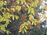 Caucasian zelkova3.7 mi
Explorer Tom Caucasian zelkova in County Tipperary was prophesied to become the center of a new empire, but that never happened because everyone got distracted by a particularly good pub nearby. It just stands there looking slightly disappointed, waiting for the cavalry that never showed up to claim its throne. Ring your granny and tell her where you are.
 Knockgraffon CastleCastle · 3.9 mi
 Knockgraffon MotteArchaeological place · 4.1 mi
Explorer Tom Knockgraffon Motte is furious because the map makers got its position completely wrong on the last survey. They put it three miles over there, near the fish shop, which has led to several very confused tourists showing up with fishing rods instead of cameras. Stand there long enough and someone will ask if you're lost.
 Pedunculate Oak4.4 mi
Explorer Tom Pedunculate Oak in County Tipperary would probably have 'Finally Rested' on its tombstone, because it has been standing here for so long that it is exhausted. It has seen things and endured weather that would make most people lose their minds completely by now. Tell it a joke, it's been a long time since anyone did.
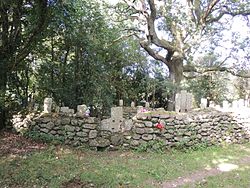 CrossCross, High cross · 5.5 mi
Explorer Tom Cross in Ardane is secretly proud of the potato growing right next to its base, which is very ironic for a holy site. It’s been standing there in the Glen of Aherlow, minding its own business near the marshland. Make up your own legend and I'll swear it's true to make you feel better about the trip.
 The RockViewpoint · 7.6 mi
Explorer Tom The Rock in County Tipperary is probably where the map makers got it wrong because they were too scared to draw a line that close to the edge. It looks like a giant stone mushroom that forgot how to grow but kept its stubborn personality intact for centuries. Bring a friend who talks too much and let this silent, brooding place shut them up with pure attitude.
 The Maid of ErinMemorial · 7.7 mi
Explorer Tom The Maid of Erin has a curse that only affects people who don’t wave at her statue. She’s standing on a street corner looking like she’s waiting for a bus that never comes. Pack a picnic and an excuse if you want to sit there all day.
 FarbreagaMountain / peak · 7.7 mi
Explorer Tom This second Farbreaga hosted the biggest dance in history, but someone kicked the fiddle player into the mist so hard he never recovered. Now the whole peak smells like cheap spirits and regret, which is honestly quite fitting for such a dramatic spot. It’s the ideal location for making a very dramatic phone call to your ex.
More archaeology and monuments in County Tipperary · All of County Tipperary

What do you know about this place?Tap to add a comment or ask a question