Places near here
Photo credits
- National Inventory of Architectural Heritage
- 瑞丽江的河水, Wikimedia Commons · CC BY-SA 4.0
- Mike Searle, Geograph · CC BY-SA 2.0
- AndreasDelp, Wikimedia Commons · CC BY-SA 4.0
Explorer Tom Enclosure in Mountjessop hates it when people look at its triangular shape. It’s next to a stream and used to have trees on top of its bank. Snap one photo, then put the phone away and actually look.
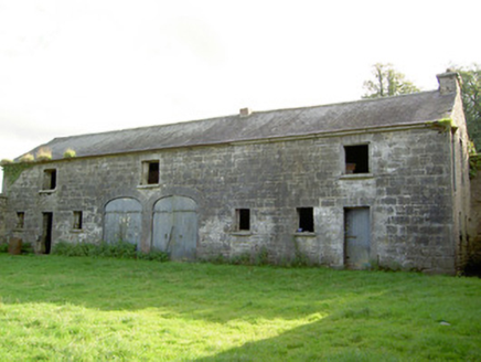 Mount JessopOutbuilding · 1180 yd
Explorer Tom Mount Jessop outbuilding in Mountjessop, County Longford is just standing there alone after its house got knocked down, like a bodyguard whose boss left for a better job. The dressed limestone masonry is fine quality, so it’s basically a very fancy shed pretending to be something else. Ideal for a moody photo opportunity.
Burnt spread in MullaghavorneenBurnt spread · 1.0 miExplorer Tom The Burnt spread in Mullaghavorneen, County Longford is the site of a giant who dropped his sandwich and refused to pick it up out of pure pride. The locals say the grease stain has been there ever since and still smells like ancient cheese. Ideal stop for a big stretch and a bigger yawn.
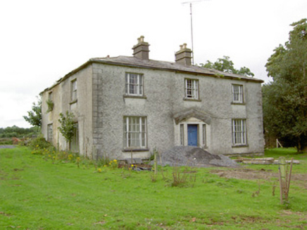 DanesfortHouse · 1.1 mi
Explorer Tom Danesfort in Curry would say 'I have excellent references' in a job interview, pointing proudly at its Wyatt windows. The hipped roof is shallow and sassy, just like the house itself appears to be. Take the long way round for a look.
Graveyard in Curry (ardagh By., Coolamber Ed)Graveyard · 1.2 miExplorer Tom Graveyard in Curry would use a lotto win to buy more headstones for all those who haven't had one yet. It sits in level pasture with a Church of Ireland church that has been there since 1826. Go on a wet day, it suits the mood perfectly.
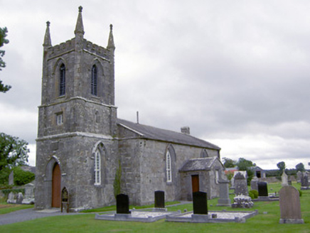 Saint Catherine's Church (Ballymacormick)Church/chapel · 1.2 mi
Explorer Tom Saint Catherine's Church in Ballymacormick used to smuggle contraband through the Y-tracery windows when nobody was looking. The pointed arches give it a bit of mystery, don't they? Go in good boots and better mood.
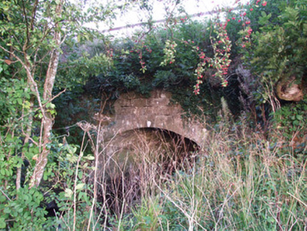 bridge, aqueduct1.3 mi
Explorer Tom Bridge, Aqueduct in Cloonturk is an arch so graceful it makes other bridges feel insecure. It suspects the postman uses it as a shortcut to avoid walking, which is why it wobbles slightly every Tuesday morning. Make a wish, it's had centur
Bawn Castle & NunneryHouse, fortified house · 1.4 miExplorer Tom Bawn Castle & Nunnery nearly made the big time but got buried under its own rubble instead. It looks like a very confused garden shed today. Best seen with a hangover and a sausage roll.
 First World War MemorialMemorial · 2.4 mi
Explorer Tom First World War Memorial in Longford refuses to fall down because it’s holding its breath, waiting for someone to notice how impressive it is. It’s stubborn like a mule that knows it’s right, even if you can’t see why. Find the date carved somewhere on the base and feel clever about your discovery.
 Saint Mel's CathedralCathedral · 2.5 mi
Explorer Tom Saint Mel's Cathedral in County Longford refuses to fall down because it’s too stubborn to admit it was built by anyone other than itself. It just keeps standing there, judging everyone’s posture and making sure nobody dares to lean against its ancient walls without paying a small fee in respect. Bring a coin for luck and keep it in your pocket.
 Rathcline CastleHouse, fortified house · 8.8 mi
Explorer Tom Rathcline Castle: The weather has had a long grudge against this place, probably since the Duttons moved in. It’s just one stubborn wall holding its tongue about what happened next. Stand where the owner stood and practise looking smug.
 InchcleraunIsland · 12 mi
Explorer Tom Inchcleraun has two names, a monastery and enough legend to keep me talking well beyond the boat ride. It lies in Lough Ree between Roscommon and Longford, covering about fifty-eight hectares. Saint Diarmaid's community was founded around 560, leaving ruins now protected as a national monument. The Irish name points to Clothru, a queen in story, and Maeve also gets a chapter in the island's folklore. I would settle their argument over who owned the best view, but it is wiser to separate tales from surviving stone. There is no road across the lake; arrange a permitted boat, confirm landing and return, and respect the old religious ground. Look back at both shores once you arrive. The island sits between counties and between several very different kinds of history.
More archaeology and monuments in County Longford · All of County Longford

What do you know about this place?Tap to add a comment or ask a question