
What is recorded here
Robert O’Farroll received Bawn in 1621, creating a manor where a fortified house later rose from limestone rubble. The circular SE tower still holds five gun loops, while the square NW tower keeps a twin-light window with diamond-shaped glazing holes. Maps call it a nunnery, yet no nunnery appears; the name is a ghost. Ivy now swallows the walls, hiding the plan but not the fact that someone built this place to be seen, defended and remembered.
Within the E sector of a possible Anglo-Norman castle (LF019-005003-). In 1621 ‘under the commission for the plantation of Longford and the territory of Ely O’Carroll’, Robert O’Farroll received the ‘castle [LF019-005003-], village and lands of Bawne 88a; … The premises created the manor of Bawne’ (Cal. pat. rolls Ire., Jas I, 533). The house may have been built following the creation of the manor. Its fragmentary and scattered remains are covered in ivy making detailed examination impossible and the plan and layout of the building difficult to ascertain. Originally the fortified house appears to have consisted of a central rectangular block (c. 10m N-S; 7m E-W), two storeys high and aligned NW-SE, with angle towers at the SE and NW corners. It is built with roughly coursed limestone rubble; a base-batter is not visible. Only a short length (L 4.7m; wall T 0.9m) of the SW wall of the central block survives, running off the SE corner of the NW angle tower. At first-floor level there is evidence of a large window with a cut-stone hood-moulding of late 16th/17th-century date.
The SE angle tower (int. diam. 2.58m; wall T 1.25m) is circular in plan. It was accessed from the house, at both ground and first-floor level, through doorways at NW. At least five gun loops are visible on the ground floor. The first floor was wooden and was carried on an offset. A stepped offset between the ground and first floor carried a circular wooden stairs.
The NW tower (int. dims. 3.04m x 2.83m; wall T 1.20m) is square in plan. It was accessed from the house, at both ground and first-floor level, through doorways in the SE angle. Gun loops are visible on the ground floor in the N and W walls. At first-floor level, in the centre of the N wall, there is a twin-light, square-headed, cut-stone window with a central stone mullion and diamond-shaped glazing-bar holes. During the 19th century the N section of the courtyard wall associated with Bawn House, now levelled, was built onto the W face of the tower.
Immediately to the NE of the SE angle tower are the fragmentary remains of a small stone bridge (LF019-005004-), which is probably contemporary with Bawn House. Named 'Bawn Castle & Nunnery' on the various editions of the OS 6-inch maps, there is no evidence that a nunnery ever existed at this location (see LF019-005005-).
Compiled by: Caimin O'Brien
Date of upload: 13 April 2012
Robert O’Farroll received Bawn Castle in 1621 as part of the plantation of Longford under the English colonial settlement policies. The site is historically significant as it reflects the displacement of native Irish landholders and the establishment of Anglo-Norman control in the region.
The monument record does not grant public access. Check the route and ask the landowner before entering private land.
- What survives
- Recorded monument
Places near here
 Enclosure in Bawn (moydow By.)Enclosure · 673 yd
 FortsFairy fort / earthen ringfort · 1089 yd
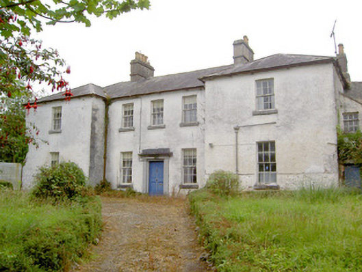 Glebe Houserectory/glebe/vicarage/curate's house · 1112 yd
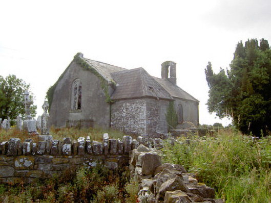 Moydow Churchchurch/chapel · 1246 yd
 Bawn in CastlereaBawn · 1.3 mi
 National Famine WayWalking route · 1.4 mi
 Graveyard in Curry (ardagh By., Coolamber Ed)Graveyard · 2.4 mi
 Bawn in LissardowlanBawn · 3.3 mi
 First World War MemorialMemorial · 3.6 mi
 Saint Mel's CathedralCathedral · 3.7 mi
 Commons North WalkVisitor information · 9.2 mi
 Wild birdsVisitor information · 9.2 mi
Other information
Photo: Credit not shown in the picture search · Rights wording not checked; contact us if this picture should be removed