
What is recorded here
Associated with a tower house (LF019-061001-). The latter is shown roughly in the centre of a subcircular enclosure (c. 75m N-S; c. 70m E-W) on the 1836 edition of the OS 6-inch map. On inspection this proved to be a drainage ditch (Wth 2m; ext. D 0.3m) that diverted water away from the interior of the possible bawn. It survives from SE-S-SW, elsewhere it has been filled in. The possible bawn is rectangular in plan (c. 52m NW-SE; c. 44m NE-SW) and is defined by field boundary walls on the NW (T 0.7m; H 0.6m) and NE (T 1m; H 0.9m) sides. The SE and SW sides have been levelled and only grass-covered wall footings are evident on the SE side, while a scarp (H 0.2m) delimits the SW side. The tower house stands in the NW quadrant of the interior, c. 4.5m to the SE of the NW wall. The gable wall (T c. 1m; H 1.5m) of a rectangular building (11m N-S; 7m E-W), covered in thorn bushes, is visible c. 10m to the NE of the NE wall. It appears to flank the S side of a cobbled roadway which could be the original roadway into the bawn. The building appears to be medieval in date and may be related to some form of gatehouse or forebuilding protecting the entrance into the bawn. This building and roadway are indicated on the 1836 edition OS 6-inch map.
Associated with a tower house (LF019-061001-). The latter is shown roughly in the centre of a subcircular enclosure (c. 75m N-S; c. 70m E-W) on the 1836 edition of the OS 6-inch map. On inspection this proved to be a drainage ditch (Wth 2m; ext. D 0.3m) that diverted water away from the interior of the possible bawn. It survives from SE-S-SW, elsewhere it has been filled in. The possible bawn is rectangular in…
From the National Monuments Service (Archaeological Survey of Ireland) record LF019-061002
The monument record does not grant public access. Check the route and ask the landowner before entering private land.
- What survives
- Recorded monument
Places near here
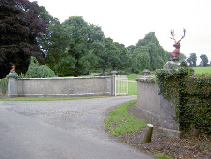 CastlereaGates/railings/walls · 373 yd
 CastlereaHouse · 386 yd
 First World War MemorialMemorial · 4.8 mi
 Saint Mel's CathedralCathedral · 4.9 mi
 Rathcline CastleHouse, fortified house · 9.6 mi
 Rathcline CastleBawn · 9.6 mi
 Leveret IslandIslet · 9.6 mi
 Ecclesiastical enclosure in InchbofinEcclesiastical enclosure · 10 mi
 InchbofinIslet · 10 mi
 Safe HarbourBay · 12 mi
 Historic town in Warren,rinnaganHistoric town · 12 mi
 RindoonWood · 12 mi
Pictures: National Inventory of Architectural Heritage; 瑞丽江的河水, Wikimedia Commons · CC BY-SA 4.0; Mike Searle, Geograph · CC BY-SA 2.0; Kieran Campbell, Geograph · CC BY-SA 2.0; David Baird, Geograph · CC BY-SA 2.0; Sailko, Wikimedia Commons · CC BY 3.0; David Baird, Wikimedia Commons · CC BY-SA 2.0; Arno-nl, Wikimedia Commons · CC BY-SA 4.0; Christopher Hilton, Wikimedia Commons · CC BY-SA 2.0
More castles and forts in County Longford · All of County Longford
What do you know about this place?