DDiscover AloneMapAbout

Castlerea

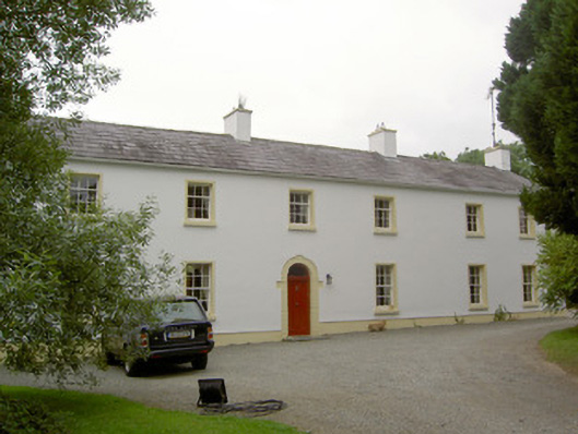
House
Castlerea
Photo: National Inventory of Architectural Heritage · Report the wrong picture

This does not grant access. Most recorded buildings are privately owned; view them only from public ground unless the owner allows entry.

What do you know about this place?Tap to add a comment or ask a question

What you write will be public.

What is recorded here

Detached six-bay two-storey house on T-shaped plan, built c. 1780, having three-bay two-storey return to rear (south). Single-storey lean-to and single-storey flat-roofed extensions to rear (north). Possibly incorporating fabric of earlier house. Pitched natural slate roof with four rendered chimneystacks, one to…

Read the whole record
Detached six-bay two-storey house on T-shaped plan, built c. 1780, having three-bay two-storey return to rear (south). Single-storey lean-to and single-storey flat-roofed extensions to rear (north). Possibly incorporating fabric of earlier house. Pitched natural slate roof with four rendered chimneystacks, one to either gable end (east and west) and two offset towards the centre Painted smooth rendered walls over painted smooth rendered plinth course. Square-headed window openings with plain smooth render surrounds, painted stone sills, and having diminishing timber sliding sash windows, three-over-six pane to first floor, six-over-six to ground floor. Round-headed door opening offset to the centre of the main elevation (south) with timber panelled door, c. 1860, and overlight set in painted dressed stone surround with prominent keystone and imposts. Timber window shutters to interior. Set back from road in extensive mature grounds to the west/southwest of Ardagh. Complex of single-storey outbuildings arranged around a yard to the rear (north) of house having random rubble limestone construction, pitched corrugated-metal (buildings to north) and slate (building to east of yard) roofs, and square-headed openings with remains of timber fittings. Ashlar limestone bellcote to west gable end of outbuilding to north having cut limestone coping and cut limestone string course. Main gateway (13401926) to the southwest of house. Gateway to the west comprising a pair of rendered gate piers (on square-plan) having double leaf wrought-iron flat bar gates. Remains of tower house (LF019-061----) to southeast.
This substantial if plain house/farmhouse retains much of its early character and form. Its front elevation is enlivened by the simple cut stone doorcase, which retains a mid-to-late nineteenth century timber panelled door. The layout of the asymmetrical façade suggests that this structure was formerly a more modest four-bay farmhouse, later extended by two bays to the east end. The narrow plan of this building, and the T-shaped from on early map (Ordnance Survey first edition six-inch map 1838), suggests that it may be of considerable antiquity, perhaps dating to the mid-eighteenth century. This building forms the centrepiece of a group of related structures along with the outbuildings to the rear and the gateway (13401926) to the southwest, which was probably added during the second half of the nineteenth century. The cut stone bellcote to the gable end of one of the buildings is an interesting feature that helps give this particularly outbuilding a strong character above its modest size, and also indicates that this was a prosperous farm at the time of construction. Castlerea was the home of a Ambrose Bole (1758 – 1805) and later a John Bole (1784 – 1847), Esq. and Justice of the Peace, in 1846 (Slater’s Directory). The Bole family had a further seat at Park House to the south, now demolished. Castlerea was reputedly built by an Isaac Bole (local information), and may have been leased by the Bole family from the Jessop and/or Montford families, who are both mentioned in wills\deeds with relation to Castlerea or Castlereagh. This house, and associated structures, is an integral part of the built heritage of the Ardagh area.

From the Buildings of Ireland (National Inventory of Architectural Heritage) record 13401908

Places near here

Photo credits
  • Mike Searle, Geograph · CC BY-SA 2.0
  • Maker not stated on source page, commons.wikimedia.org
  • Kmcnamee, Wikimedia Commons · CC BY-SA 4.0
  • National Inventory of Architectural Heritage
  • Maker not stated on source page, irishheritagenews.ie
  • Maker not stated on source page, www.thejournal.ie
  • Maker not stated on source page, fi.pinterest.com
  • Maker not stated on source page, www.pinterest.com
  • Maker not stated on source page, au.pinterest.com
Bawn in CastlereaBawn · 386 yd

Explorer Tom Bawn in Castlerea is surrounded by a drainage ditch that looks like someone gave up halfway. There is a curse that only…

Standing stone in GarranboyStanding stone · 849 yd

Explorer Tom Standing stone in Garranboy is absolutely sick of being asked if it’s pointing at something specific. It just likes…

Moydow, Ardagh MoydowGAA ground · 1027 ydMoydow Old Parish GraveyardGraveyard · 1086 yd

Explorer Tom Moydow Old Parish Graveyard is in a furious dispute with the fairies over who gets to park their carriages there first.…
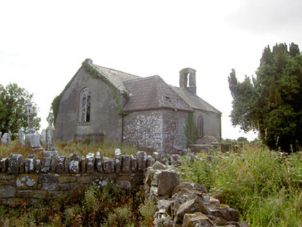
Moydow ChurchChurch/chapel · 1102 yd

Explorer Tom Moydow Church in Moydow Glebe, County Longford is derelict but its bellcote still looks like it’s trying to ring itself…

Fairy fort / earthen ringfort in Aghinaspick,toneen (moydow By.)Fairy fort / earthen ringfort · 1301 yd

Explorer Tom Fairy fort / earthen ringfort in Aghinaspick, Toneen is supposedly haunted by a giant who got stuck in the gate and…
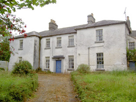
Glebe HouseRectory/glebe/vicarage/curate's house · 1323 yd

Explorer Tom Glebe House at Moydow insists its long driveway is a shortcut that isn’t. It’s all grandeur and self-importance, like a…
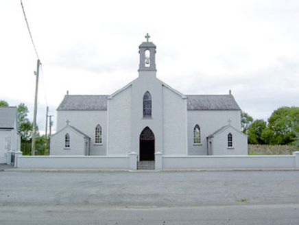
Saint Mary's Catholic ChurchChurch/chapel · 1342 yd

Explorer Tom Saint Mary's Catholic Church in Aughine has a retirement plan that involves turning into a very expensive shed by next…

Fairy fort / earthen ringfort in CommockFairy fort / earthen ringfort · 1480 yd

Explorer Tom Fairy fort / earthen ringfort in Commock is invisible except for a curve in the bank. It's proud of being so subtle…

Moydow CemeteryCemetery · 1497 yd

Explorer Tom Moydow Cemetery would bring a bag of old bones to any party it attends, claiming they’re just props. It’s the life of…

Fairy fort / stone ringfort in Castlerea MountainFairy fort / stone ringfort · 1523 yd

Explorer Tom Fairy fort / stone ringfort in Castlerea Mountain would be the guest at a wedding who stands by the wall. It’s on a…

CastleCastle, unclassified · 1.2 mi

Explorer Tom Castle in Cloonmucker would survive a zombie attack by simply hiding in a different townland until they get bored. It’s…

More historic places in County Longford · All of County Longford

Add to this placeAdd a picture Add a detailed tip Add a story

Explore the map1,095,414 places to discover

Next place · or swipeBawn in Castlerea