
What is recorded here
Monument surveyed by ASI in 1978 and described as following; 'A small roughly circular mound of earth and stone. There is a broad shallow fosse at the foot of the mound on the W with a straight stretch of low earthen bank outside it. This bank seems to be part of an old field bank and it is possible that the fosse is…
Read the whole record
Monument surveyed by ASI in 1978 and described as following; 'A small roughly circular mound of earth and stone. There is a broad shallow fosse at the foot of the mound on the W with a straight stretch of low earthen bank outside it. This bank seems to be part of an old field bank and it is possible that the fosse is associated with this and is not an original feature. There are no indications of either fosse or bank to be seen elsewhere. A few fairly large stones can be seen in the base of the mound on the N and NW, may be part of a kerb. A second line (?) of largish stones can be seen approx. halfway up the side of the mound, also on the W and on the E. Unfortunately the mound seems to have been used as a dump for a small number of field stones. The top of the mound is flat but has been disturbed by cattle on the E and N. There is a stump of thorn tree in the edge of the mound on the S. The site is on top of rise in undulating pasture land. There are good views in all directions and extensive views to the SW and S. The mound has slipped somewhat on the E-NE' (ASI File 12/06/1978).
From the National Monuments Service (Archaeological Survey of Ireland) record WM032-033
Places near here
Picture notes
- Computer-made picture. It does not show this monument.
- National Inventory of Architectural Heritage
- Computer-made picture. It does not show this playground.
- Mike Searle, Geograph · CC BY-SA 2.0
- Maker named on the Wikimedia Commons picture page · CC BY-SA 2.5
 Raghnagalliagh FortArchaeological place · 158 ydComputer-made picture
 OutlinedFairy fort / earthen ringfort · 627 ydComputer-made picture
 Fairy fort / earthen ringfort in BallyhastFairy fort / earthen ringfort · 1043 ydComputer-made picture
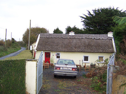 The ThatchHouse · 1056 yd
 Fairy fort / earthen ringfort in BallynacoskaFairy fort / earthen ringfort · 1153 ydComputer-made picture
 Fairy fort / earthen ringfort in DromoreFairy fort / earthen ringfort · 1210 ydComputer-made picture
 Fairy fort / earthen ringfort in KilbalraherdFairy fort / earthen ringfort · 1342 ydComputer-made picture
 Fairy fort / earthen ringfort in SraneegFairy fort / earthen ringfort · 1633 ydComputer-made picture
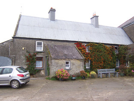 Garhy LodgeHouse · 1640 yd
 Children's playground1.3 miComputer-made picture
 Laragh CastleCastle · 4.0 mi
 Sessile Oak10 mi
More archaeology and monuments in County Westmeath · All of County Westmeath

What do you know about this place?Tap to add a comment or ask a question