What is recorded here
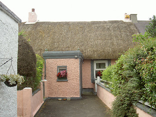
Detached three-bay single-storey thatched house, built c. 1780. Rectangular-plan, squared flat-roofed porch to north (main) elevation, lean-to extension and single-pitch corrugated-iron roofed outbuilding to east, lean-to extension to south. Pitched roof, thatched straw to north pitch, corrugated-iron to south pitch, painted smooth rendered ridge and skews to gables, painted smooth rendered chimneystacks to centre ridge and west gable, painted lime-rendered aprons, moulded metal gutters to south elevation. Painted roughcast-rendered walling to north elevation and porch, painted smooth rendered plinth, painted smooth rendered straight quoins to porch corners; painted smooth rendered cornice to porch with coloured glass balls finials to corners of roof; lime-rendered walling to south and east elevations. Square-headed window openings, painted stone sills, painted smooth rendered reveals and window surrounds, one original painted timber fixed casement window, uPVC casement windows. Square-headed door opening to west elevation of porch, painted smooth rendered surround, varnished timber panelled door. Garden to north, bounded by painted lime-rendered walling, painted lime-rendered coping, square piers, iron gates.
This structure is an attractive example of a thatched house. Well-proportioned with typical layout of an Irish vernacular building it offers architectural interest to the area as one of the few remaining thatches. The main elevation of the vernacular house has been given more attention with its corniced porch and simple surrounds to windows and door.
This does not grant access. Most recorded buildings are privately owned; view them only from public ground unless the owner allows entry.
Places near here
 IndicatedGraveyard · 968 yd
 Church in ruinsChurch · 968 yd
 ToberhullamagHoly well · 1207 yd
 CastleCastle, tower house · 1759 yd
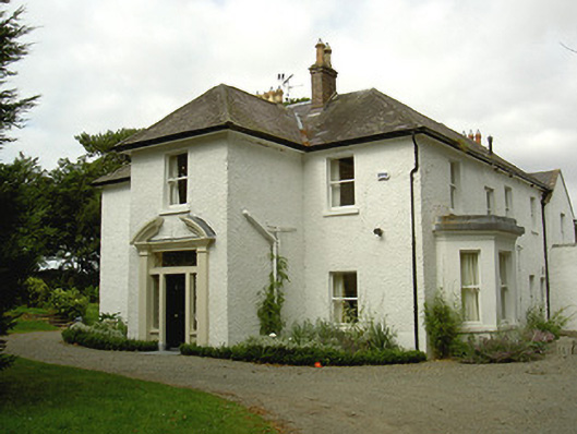 Ballygassan Househunting/fishing lodge · 1.1 mi
 Tullydonnell HillMountain / peak · 2.5 mi
 GreenmountCastle, motte and bailey · 2.9 mi
 Graveyard in DysartGraveyard · 3.2 mi
 Sweet baySweet bay · 3.4 mi
 European YewEuropean Yew · 3.4 mi
 Drummeenagh HillMountain / peak · 3.9 mi
 Chapel (in Ruins), GraveyardChurch · 4.7 mi
Other information
Photo: National Inventory of Architectural Heritage · Website use allowed for educational or private purposes with source credit