What is recorded here
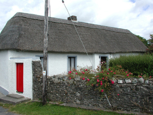
Detached five-bay single-storey thatched cottage, c.1830, with single-bay single-storey advanced porch to centre. Extensively renovated, c.1980. Hipped roof with reed thatch having rope work to ridge, and red brick Running bond squat chimney stack. Painted replacement roughcast walls, c.1980, over mud and random…
Read the whole record
From the Buildings of Ireland (National Inventory of Architectural Heritage) record 22902508
Places near here
Photo credits
- National Inventory of Architectural Heritage
- Maker not stated on source page, in.pinterest.com
- Maker not stated on source page, www.tripadvisor.com.sg
- Maker not stated on source page, www.dreamstime.com
- Maker not stated on source page, commons.wikimedia.org
- A.-K. D., Wikimedia Commons
- Veekrokki, Wikimedia Commons · Public domain
- Maker not stated on source page, www.pinterest.com
- Maker not stated on source page, www.gettyimages.ae
- Jonathan Thacker, Geograph · CC BY-SA 2.0
 farm house830 yd
Explorer Tom This farmhouse in Ballyristeen is trying to be historical with its fake historic window fittings, which looks about as…
 Church in KilduaneChurch · 879 yd
Explorer Tom Church in Kilduane is an unlocated site called An tSeana Shráid, which translates to 'the old street' but sounds like a…
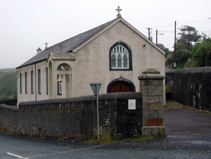 Saint Mary's Catholic ChurchOfficially recorded historic building · 1445 yd
Explorer Tom Saint Mary's Catholic Church in Kilduane was originally built for copper mine workers, so it still smells faintly like…
 St. Mary's Church Saleen, BonmahonVisitor information · 1451 yd
Explorer Tom St. Mary's Church Saleen, Bonmahon has a family tree that includes at least three ghosts and a very stubborn donkey…
 Graveyard in KilmurrinGraveyard · 1591 yd
Explorer Tom Kilmurrin has a church dedicated to Murina, sister of St. Baramedan, which is a name that rolls off the tongue like wet…
 Church in KilmurrinChurch · 1591 yd
Explorer Tom Church in Kilmurrin in County Waterford would tell you secrets about the sea after three pints. It’s dedicated to…
 mine/pit1664 yd
Explorer Tom Mine or pit in Ballynagigla is where copper dreams went to die, and honestly, I’d bet my left shoe that a famous rock…
 Copper Coast Geopark Visitor CentreVisitor information · 1.2 mi
Explorer Tom The Copper Coast Geopark Visitor Centre in Bunmahon has a neat trick: it packs ancient volcanoes, tropical seas and…
 Copper CoastCoastal geological landscape · 1.2 mi
Explorer Tom Copper Coast claims a goat once ruled the entire coastline from its highest point. The goat is long gone now, but the…
 Ogham stone (present location) in BallynagiglaOgham stone (present location) · 1.2 mi
Explorer Tom Ogham stone in Ballynagigla, County Waterford has a long-standing grudge against the weather because it’s been stuck…
 Mapped graveyardGraveyard · 1.2 mi
Explorer Tom Mapped Graveyard in County Waterford would buy a giant pair of sunglasses if it won the lotto, just to hide its eyes…
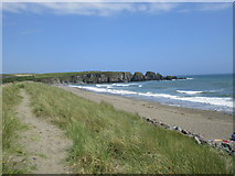 Bunmahon StrandBeach / strand · 1.4 mi
Explorer Tom Bunmahon Strand is that awkward uncle at the wedding who keeps spilling red wine on his trousers and apologising to the…
More historic places in County Waterford · All of County Waterford

What do you know about this place?Tap to add a comment or ask a question