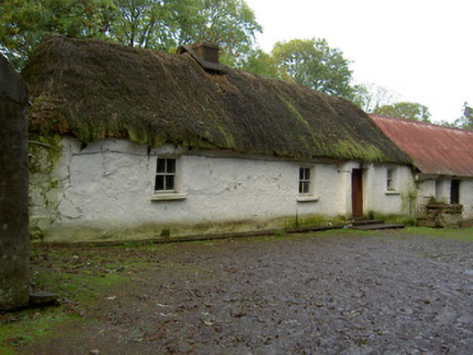
What is recorded here
Detached four-bay single-storey, direct-entry thatched house, built c. 1800, having windbreak to front. Hipped thatched roof with low rendered chimneystack. Painted rendered walls. Square-headed openings with two-over-two pane timber sliding sash windows and painted render sills. Square-headed timber battened door and…
Read the whole record
From the Buildings of Ireland (National Inventory of Architectural Heritage) record 20901502
Places near here
Photo credits
- National Inventory of Architectural Heritage
- Maker not stated on source page, www.gpsmycity.com
- Kmcnamee, Wikimedia Commons · CC BY-SA 4.0
- Maker not stated on source page, www.pinterest.com
- Maker not stated on source page, www.tripadvisor.ca
- Maker not stated on source page, en.wikipedia.org
- Maker not stated on source page, tr.pinterest.com
- Maker not stated on source page, www.hillwalktours.com
- Maker not stated on source page, www.dreamstime.com
- Maker not stated on source page, heritagecalling.com
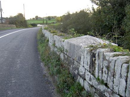 Allow BridgeBridge · 575 yd
Explorer Tom Allow Bridge is a hump-back affair from 1834 designed by Richard Griffith. The carved caps on the piers are nice work…
 Church in GortnascreggaChurch · 1155 yd
Explorer Tom Gortnascregga Church ended up on the wrong side of a fence and never moved back. It's marked by mounds that look like…
 Freemount GAA pitchGAA ground · 1328 yd
 Church in KeeltaneChurch · 1736 yd
Explorer Tom Church in Keeltane is a rectangular raised area with a long list of former names it can't remember. It’s 90 square…
 Church in Coolbane (duhallow By., Tullylease Par.)Church · 1.1 mi
Explorer Tom Church in Coolbane has very strong opinions on modern buildings and thinks they’re all show-offs. There is now no sign…
 Church in KnockillyChurch · 1.2 mi
Explorer Tom Church in Knockilly has a grassy mound that’s suspiciously tidy, likely because the postman checks up on it weekly.…
 Church in KilknockaneChurch · 1.3 mi
Explorer Tom Church in Kilknockane is playing hide-and-seek with me and winning. A guy named Bowman said there were mounds, but now…
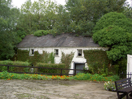 Coolbane MillMill (water) · 1.4 mi
Explorer Tom Coolbane Mill has a cast-iron wheel that looks like it’s about to start spinning again. Built in 1850, it ground corn…
 Standing stone in Ballybane (duhallow By.)Standing stone · 1.8 mi
Explorer Tom Standing stone in Ballybane is one of two recorded by Bowman, sitting 49 yards apart with no known exact location now.…
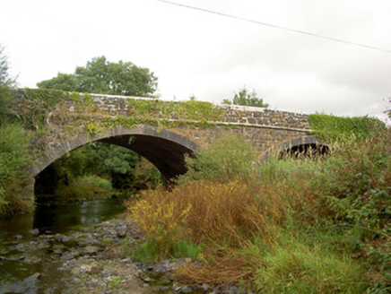 Raheen BridgeBridge · 1.9 mi
Explorer Tom Raheen Bridge in Muckenagh has a finely executed limestone finish that would make a mason weep with joy or envy. It…
 Standing stone in PoulavareStanding stone · 3.7 mi
Explorer Tom Standing stone in Poulavare was recorded by Bowman in 1934 as being nearly four feet high. But nobody knows the exact…
 Kilbrin GAA pitchGAA ground · 4.9 mi
More historic places in County Cork · All of County Cork

What do you know about this place?Tap to add a comment or ask a question