What is recorded here
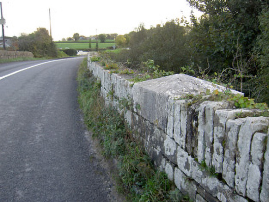
Double-arch road bridge over River Allow, dated 1834, having rubble sandstone walls and parapets with square-profile limestone piers having carved caps. Cut limestone name and date plaque to north elevation. Limestone V-cutwaters to north elevation.
This slightly hump-back road bridge was designed by Richard Griffith. It is solidly constructed with rubble sandstone masonry walls. The plaque is finely carved and is clearly the work of skilled craftsmen. The bridge serves as a reminder of the quality of the engineering and local craftsmen's skills in the mid-nineteenth century.
This does not grant access. Most recorded buildings are privately owned; view them only from public ground unless the owner allows entry.
Places near here
 Allow BrBridge · 11 yd
 St Johns Catholic ChurchChurch · 793 yd
 Man-made underground passage in FreemountMan-made underground passage · 1074 yd
 Holy well in KeeltaneHoly well · 1700 yd
 Castle LisheenCastle · 3.5 mi
 Liscarroll CastleCastle · 3.7 mi
 Battle of LiscarrollMajor battlefield · 3.7 mi
 Stanner's Glen, Priory WoodWood · 4.3 mi
 National Co-op MuseumMuseum · 4.7 mi
 Burial ground in AssolasBurial ground · 7.1 mi
 European YewEuropean Yew · 7.2 mi
 Mullaghareirk - Banane LoopWalking route · 7.3 mi
Other information
Photo: National Inventory of Architectural Heritage · Website use allowed for educational or private purposes with source credit