
What is recorded here
Road bridge (Wth 7.5m; long axis NE-SW) over Allow River, to SW of Freemount. Coursed ashlar sandstone construction with limestone detail. Two large elliptical arches (span c. 8-10m), projecting course over the arch rings; linear band course above arch. Bluntly pointed cutwater on both sides. Vertical stone coping on parapet wall which overhangs on external sides. Piered abutments at either end of parapet wall with limestone caps; caps have central hole. Stone plaque in parapet wall reads 'G IV R Alla Bridge Richard Griffith Engineer 1824'.
The above description is derived from the published 'Archaeological Inventory of County Cork. Volume 4: North Cork' (Dublin: Stationery Office, 2000). In certain instances the entries have been revised and updated in the light of recent research.
Date of upload/revision: 14 January 2009
The monument record does not grant public access. Check the route and ask the landowner before entering private land.
- What survives
- Recorded monument
Places near here
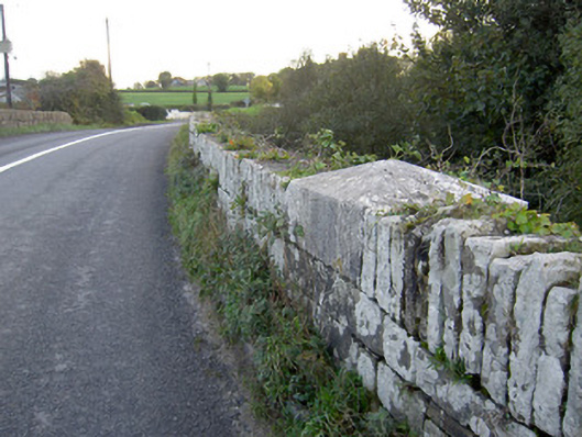 Allow Bridgebridge · 11 yd
 St Johns Catholic ChurchChurch · 784 yd
 Man-made underground passage in FreemountMan-made underground passage · 1063 yd
 Holy well in KeeltaneHoly well · 1704 yd
 Castle LisheenCastle · 3.5 mi
 Liscarroll CastleCastle · 3.7 mi
 Battle of LiscarrollMajor battlefield · 3.7 mi
 Stanner's Glen, Priory WoodWood · 4.3 mi
 National Co-op MuseumMuseum · 4.7 mi
 Burial ground in AssolasBurial ground · 7.1 mi
 European YewEuropean Yew · 7.2 mi
 Mullaghareirk - Banane LoopWalking route · 7.3 mi
Other information
Photo: Credit not shown in the picture search · Rights wording not checked; contact us if this picture should be removed