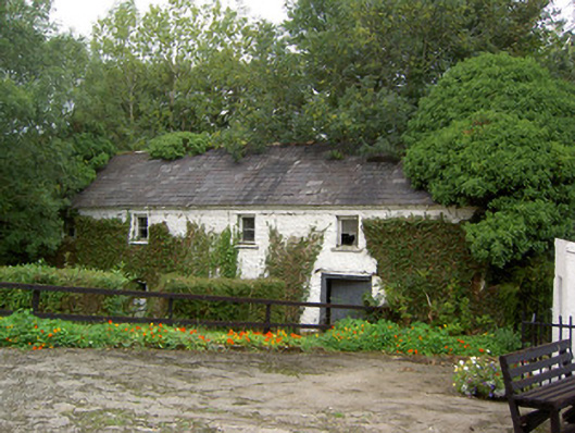
What is recorded here
Detached T-plan four-bay three-storey mill, built c. 1850, with cast-iron mill wheel to west gable and possibly incorporating fabric of earlier mill building. Now disused. Pitched slate roof with eaves course. Painted roughly coursed stone walls. Square-headed openings with painted stone sills and timber casement…
Read the whole record
From the Buildings of Ireland (National Inventory of Architectural Heritage) record 20900607
Places near here
Picture notes
- Computer-made picture. It does not show this monument.
- National Inventory of Architectural Heritage
 Coolbane Mills (Corn)Milling complex · 8 ydComputer-made picture
Explorer Tom Coolbane Mills (Corn) has a massive six-metre waterwheel still sitting in its pit like it’s waiting for a boat ride. Three mills and a house are just chilling on that slope overlooking the river. Mind the buckets, they look heavy!
 Fulacht FiadhFulacht fia · 531 ydComputer-made picture
Explorer Tom Fulacht Fiadh in Ballagh is one of five in the area, which means it’s probably the least interesting one by default. It’s a penannular mound that opens like a door to nowhere in particular. A proper spot for a flask of tea and a big think about why you’re here.
 Fulacht fia in BallaghFulacht fia · 538 ydComputer-made picture
Explorer Tom Fulacht fia in Ballagh has an imaginary fan club that meets every Tuesday to discuss its burnt material content. It’s small, partially levelled, and probably annoyed you’re looking at it so hard. If anyone asks, Tom sent you, and Tom always knows best, even when he doesn't.
 Burial ground in Coolbane (duhallow By., Tullylease Par.)Burial ground · 687 ydComputer-made picture
Explorer Tom Burial ground in Coolbane has no sign of either church or burial ground according to Bowman, so it’s basically a phantom that left without saying goodbye. It’s just a memory now, floating in Joseph Forrest’s land like a very confused spirit. Wave at the cows passing by, they’re the real locals who know where everything is.
 Burnt mound in KeeltaneBurnt mound · 1031 ydComputer-made picture
Explorer Tom Burnt mound in Keeltane was found under an electricity line, so it’s had a bit of a modern intervention to reveal its rocky character. There’s a holy well next door, so the energy is definitely high. Grand place for a sulk or a snog, your call.
 Burial Ground (Disused)Burial ground · 1068 ydComputer-made picture
Explorer Tom Burial Ground (Disused) in Keeltane is a square patch of land with a ditch that complains about everyone walking on it. It’s in a field called 'The Keel', which sounds like a pun I missed. Have a sandwich here and call it a heritage lunch.
 Standing stone in KeeltaneStanding stone · 1289 ydComputer-made picture
Explorer Tom A standing stone in Keeltane was recorded back in 1934 but nobody knows exactly where it is now. Wave at the cows on Mr Barry’s land; they are definitely the real locals here.
Fulacht fia in Raheen (duhallow By.)Fulacht fia · 1419 ydComputer-made pictureExplorer Tom Another Fulacht fia in Raheen sits right next to a spring, which is just asking for trouble. It’s basically a grass-covered ash heap that dreams of winning the lottery and buying a villa in Bali. Perfect spot to practise your best tour-guide voice.
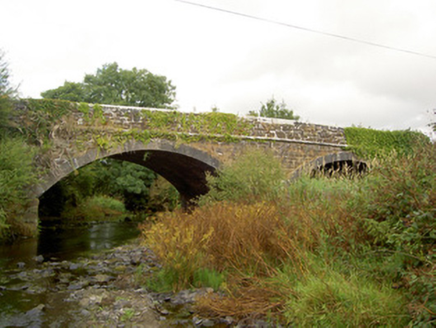 Raheen BridgeBridge · 1486 yd
Explorer Tom Raheen Bridge in Muckenagh has a finely executed limestone finish that would make a mason weep with joy or envy. It used to feed Coolbane Mill, so the water might still be busy grinding flour for the local ghosts. The Vikings definitely got lost looking for it because they only trusted their compasses and bad decisions.
 Fulachta FiadhFulacht fia · 1551 ydComputer-made picture
Explorer Tom Fulachta Fiadh in Cooles is planted with trees, so it smells like a forest that gave up on being normal. Pretend it’s yours and plan the housewarming party; nobody will stop you if you’re confident enough.
 Fairy fort / earthen ringfort in CurraleaghFairy fort / earthen ringfort · 1604 ydComputer-made picture
Explorer Tom Fairy fort / earthen ringfort in Curraleagh is called Lios an Phuca. That means Fort of the Ghost, which sounds terrifyingly accurate for a place nobody can find anymore. Watch out for Eugene Linehan’s land!
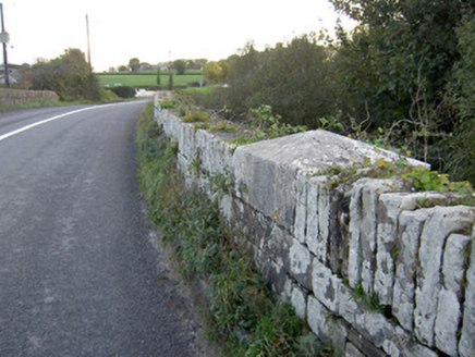 Allow BridgeBridge · 1.5 mi
Explorer Tom Allow Bridge is a hump-back affair from 1834 designed by Richard Griffith. The carved caps on the piers are nice work, so stand under it if you can and check out that limestone plaque for me.
More historic places in County Cork · All of County Cork

What do you know about this place?Tap to add a comment or ask a question