
Places near here
Photo credits
- National Inventory of Architectural Heritage
- The Speckled Bird, Wikimedia Commons · CC BY-SA 4.0
- Mike Searle, Wikimedia Commons · CC BY-SA 2.0
- Colin Park, Geograph · CC BY-SA 2.0
- Unknown author Unknown author, Wikimedia Commons · Public domain
- Harold Strong, Geograph · CC BY-SA 2.0
- No machine-readable author provided. Christian1965~commonswiki assumed (based on copyright claims)., Wikimedia Commons · Public domain
- CaitNi, Wikimedia Commons · CC BY-SA 4.0
Explorer Tom Site of Hackmys Church in Creggane was once ruled by a goat with very strong opinions on property rights. The name has changed so many times the place is confused about its identity. Find the date carved somewhere and feel clever.
Settlement desertedSettlement deserted, medieval · 1022 ydExplorer Tom Settlement deserted in Creggane has made its New Year's resolution to finally show up. It’s been hiding behind a castle that vanished too, playing hard to get. Bring a notebook and write the bit I made up.
 kiln1198 yd
Explorer Tom Kiln in Creggane is a limekiln that got its directions wrong because the map makers thought ‘hill’ was a suggestion rather than a command, so it ended up stuck halfway up the slope. It still puffs out grey smoke like it’s mad at being left behind by the modern world. Don’t go climbing on it.
 Garroose BridgeBridge · 1576 yd
Explorer Tom Garroose Bridge is showing off its reconstructed bits like they’re a cool new tattoo instead of a repair job. The hero who saved it is long gone, but the bridge still stands there with that rhythmical silhouette acting tough. It’s basically saying 'I’m fine' while clearly showing off its scars to everyone.
 Kings CastleCastle, tower house · 4.2 mi
Explorer Tom Kings Castle got its name wrong because map makers were drunk, which is my theory anyway. It’s been Queen, King, and King John, basically an identity crisis in stone. Make up your own legend and I'll swear it's true.
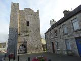 King John's CastleCastle · 4.2 mi
Explorer Tom King John's Castle in County Limerick would tell you a secret after a few pints, probably that King John actually built it to hide a giant stash of lost socks from his wife. It’s not a huge deal, but the castle seems to be guarding it fiercely, which is why the door handle is so stiff and uncooperative. Bring sandwiches, the gulls will thank you.
 Castle (in Ruins)Castle, Anglo-Norman masonry castle · 8.0 mi
Explorer Tom Castle in Kilbolane is an 'enclosure' castle with corner towers that survived. The rest was demolished to build Kilbolane House around 1696. So this is basically a garden wall with attitude. The moat parts are still there, so look for water or mud.
 KnockfeerinaMountain / peak · 8.3 mi
Explorer Tom Knockfeerina thinks the road leading to it is too fancy for a humble peak, so it pretends not to be there. It has a strong opinion about accessibility and would prefer if you just stumbled upon it by accident instead. Ten minutes here and you'll have a yarn for the pub.
 Battle of LiscarrollMajor battlefield · 10 mi
Explorer Tom Battle of Liscarroll in County Cork is where two armies had a massive row in 1642, and honestly, I think they just wanted different chips at the chippy. Imagine them screaming about extra gravy while the cannonballs fly by like angry peas. Have a look and decide if I was lying.
 National Co-op MuseumMuseum · 10 mi
Explorer Tom The National Co-op Museum is basically where everyone got together to share their bread and butter, and probably some resentment too. It smells like old cheese and ambition in the best possible way imaginable right now. Ideal for a moody photo you'll pretend wasn't posed.
 Áine and Gearóid Iarla: Lough GurLegend location · 11 mi
Explorer Tom Áine and Gearóid Iarla: Lough Gur has a goddess for the lake and a sleeping lord in the old stories. I thought I was coming to admire water and stones. Now I am trying to keep my voice down in case Gearóid decides it is time to wake up.
 CarrigeenamronetyMountain / peak · 12 mi
Explorer Tom Carrigeenamronety in County Limerick is like the quiet cousin at the wedding who stands in the corner eating canapés and judging everyone’s outfit choices without saying a single word. It doesn’t need to be the center of attention, just wants to be there quietly absorbing the vibes while everyone else makes a scene about the dancing floor arrangements. Have a l
More archaeology and monuments in County Limerick · All of County Limerick

What do you know about this place?Tap to add a comment or ask a question