What is recorded here
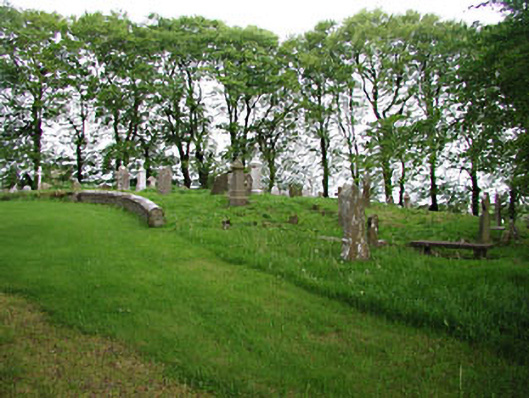
Graveyard or cemetery in Moat has two ruined houses beside it and eight-sided gate piers. Give an estate salesman ten minutes and he’ll have you bidding on ‘a gated development of two homes, excellent ventilation, exceptionally settled neighbours’.
Graveyard, with medieval interments, having eighteenth- and nineteenth-century stone grave markers. Private graveyard to the north. Remains of church to site. Rubble stone boundary walls with octagonal gate piers and cast-iron double gates. Pair of houses now in ruins to the east.
This well maintained graveyard has fine examples of grave markers from the eighteenth and nineteenth centuries, some of which have carved decorative details. The medieval grave markers add archaeological interest to the site. The pair of houses, though now in ruins, contribute to the setting.
From the Buildings of Ireland (National Inventory of Architectural Heritage) record 14400806
This does not grant access. Most recorded buildings are privately owned; view them only from public ground unless the owner allows entry.
Places near here
 European Beech7 ydEcclesiastical enclosure in Moat (fore By.)Ecclesiastical enclosure · 61 yd
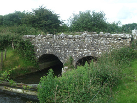 Ballinacree BridgeBridge · 1589 yd
 mill (water)1.1 mi
 CastleCastle, motte and bailey · 1.4 miMount FortuneMountain / peak · 2.0 mi
 Mullaghmeen ForestPicnic place · 2.3 mi
 MoatCastle, motte · 3.5 mi
 European Yew3.6 mi
 LoughcrewMegalithic tomb cemetery · 3.9 mi
 Hag's ChairArchaeological place · 4.5 mi
 Slieve Na CalliaghMountain / peak · 4.6 mi
Pictures: Malene Thyssen, Wikimedia Commons · CC BY-SA 3.0; National Inventory of Architectural Heritage; Kieran Campbell, Geograph · CC BY-SA 2.0; Britishfinance, Wikimedia Commons · CC BY-SA 4.0; Mike Searle, Geograph · CC BY-SA 2.0; Sitomon, Wikimedia Commons · CC BY-SA 2.0; John M, Wikimedia Commons · CC BY-SA 2.0; James Fergusson, after E. Conwell, Wikimedia Commons · Public domain; Bill Griffiths, Wikimedia Commons · CC BY-SA 2.0
More historic places in County Meath · All of County Meath
What do you know about this place?