
Places near here
Photo credits
- Kmcnamee, Wikimedia Commons · CC BY-SA 4.0
- National Inventory of Architectural Heritage
- Maker named on the Wikimedia Commons picture page · CC BY-SA 2.5
- Miguel Angel Masegosa Martínez, Wikimedia Commons · CC BY 2.0
- Sarah777 at English Wikipedia, Wikimedia Commons · Public domain
- Jonathan Billinger, Wikimedia Commons · CC BY-SA 2.0
 Tinahely GAAGAA ground · 1520 yd(Site of) Raymond CastleCastle, unclassified · 1581 yd
Explorer Tom Raymond Castle in Killaveny would win the county fair’s ‘Most Confused Object’ prize every single year without even…
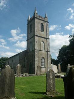 Kilcommon ChurchChurch/chapel · 1630 yd
Explorer Tom Kilcommon Church holds the unofficial world record for having the most specific stained glass window dedication to a…
Enclosure in KillavenyEnclosure · 1721 ydExplorer Tom Enclosure in Killaveny hears everything through its walls, mostly people complaining about how invisible it is since…
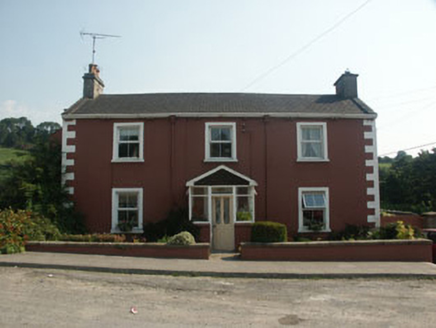 Ballinacor HouseHouse · 1.1 mi
Explorer Tom Ballinacor House in Tinahely is locked in a bitter feud with the rain because it lost its original windows. It looks…
IndicatedEnclosure · 1.4 miExplorer Tom Enclosure in Rosnastraw holds a curse that only affects people who don't wave hello first, which is why half the locals…
1798 Lacey Brothers MemorialMemorial · 2.0 miExplorer Tom The 1798 Lacey Brothers Memorial would cope brilliantly on a reality show because it knows exactly how to look…
Coolboy Community Field, Shillelagh-Coolboy GAAGAA ground · 2.2 mi Sessile Oak2.5 mi
Explorer Tom Sessile Oak in County Wicklow would ace any job interview because it has over two hundred years of continuous…
 Sweet Chestnut3.1 mi
Explorer Tom Sweet Chestnut in County Wicklow was once the headquarters for a matchmaker who paired off locals based on how well…
 Annagh HillMountain / peak · 4.1 mi
Explorer Tom Annagh Hill above Ballyfad offers woodland climbing, open views and a hurling tale bold enough to make Tom suspicious…
 Monalee HillMountain / peak · 4.6 mi
Explorer Tom Monalee Hill suspects the postman is stealing letters and hiding them in the turf. It’s been glaring at the road every…
More archaeology and monuments in County Wicklow · All of County Wicklow

What do you know about this place?Tap to add a comment or ask a question