
Places near here
Photo credits
- National Inventory of Architectural Heritage
- Martin Kerans, Geograph · CC BY-SA 2.0
- Mike Searle, Geograph · CC BY-SA 2.0
- Kmcnamee, Wikimedia Commons · CC BY-SA 4.0
- Mike Searle, Wikimedia Commons · CC BY-SA 2.0
- dougf, Wikimedia Commons · CC BY-SA 2.0
- Rryswny, Wikimedia Commons · CC BY-SA 4.0
- John M, Geograph · CC BY-SA 2.0
- Humphrey Bolton, Geograph · CC BY-SA 2.0
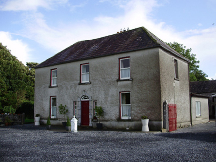 Carheen HouseHouse · 265 yd
Explorer Tom Carheen House is being picked on by the wind because its chimneystack bends back like a weird question mark. The carved…
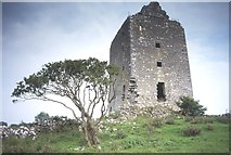 Cregg Castle (in ruins)Castle, tower house · 722 yd
Explorer Tom Cregg Castle in Lakyle is a ghost town that forgot to send out the eviction notice. It’s been sitting there long enough…
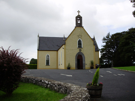 Saint Killian's Catholic ChurchChurch/chapel · 1104 yd
Explorer Tom Saint Killian's Catholic Church in Ballymanagh would post a selfie of its carved bellcote with a hashtag. It’s sitting…
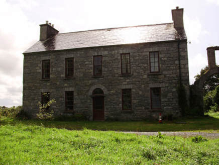 Kilquain HouseHouse · 1.3 mi
Explorer Tom Kilquain House in Kilquain is being run by a very stern dog who checks every window for symmetry. The square-headed…
 Strongfort Castle (in ruins)Castle, tower house · 2.6 mi
Explorer Tom Strongfort Castle was refurbished in the 1980s with concrete floors, so it’s now basically a modern flat with medieval…
 Craughwell GAAGAA ground · 2.9 mi
 Designed landscapeDesigned landscape, folly · 3.1 mi
Explorer Tom Designed landscape in Castleboy is a folly, which means it’s expensive nonsense. I swear there’s a curse on anyone who…
Páirc Thomáis Naofa, Castleboy, St. Thomas GAAGAA ground · 3.5 mi Round Tower (in ruins)Round tower · 4.9 mi
Explorer Tom Round Tower in Ardrahan North has been reduced to a few courses of limestone hidden under cemetery ground. Nobody knows…
 Drumacoo Monastic SiteHeritage attraction · 8.3 mi
Explorer Tom Drumacoo Monastic Site near Ballinderreen has a roofless church, a living graveyard and a holy well: plenty of history…
 Kilmacduagh Monastic SiteVisitor information · 12 mi
Explorer Tom Kilmacduagh Monastic Site thinks Dublin tourists are basically overgrown children who need a stern lecture about…
 Kilmacduagh MonasteryHeritage attraction · 12 mi
Explorer Tom Kilmacduagh gives you a round tower and a name that has outlived several different churches. I would call it the seven…
More archaeology and monuments in County Galway · All of County Galway

What do you know about this place?Tap to add a comment or ask a question