
What is recorded here
Strongfort Castle stands as a rectangular tower house beside the Dunkellin River in County Galway, built during the late 16th or early 17th century to command a vital river crossing. Its narrow chamber and spiral stairs suggest a small garrison watched the water for invaders or traders, while musket loops in the corner bartizans allowed defenders to strike without exposing themselves. The 1980s refurbishment added concrete floors and reconstructed crenellations, transforming a fragile military ruin into a habitable residence that still shadows the farmland below.
On the E side of a by-road in undulating farmland and commanding a crossing-point on the Dunkellin River c. 30m to the SSE. This rectangular tower house (c. 9.5m N-S; c. 8.6m E-W) is probably of late-16th or early 17th-century date. It was refurbished as a modern residence in the 1980s, in the course of which modern concrete floors and windows were inserted, and the parapets were reconstructed complete with crenellations (see Shaffrey 1985, 55). The original tower, which appears to have been of at least two storeys, had a doorway centrally placed in the E wall. This gave access to a lobby from which doorways led to a small chamber/guardroom in the SE corner, the spiral stairs in the NE corner and to main ground-floor room. A fireplace in the N wall of this room may be a modern insertion. A short garderobe passage opens off the stairs in the same wall on the 1st floor. There are two angle bartizans with musket loops at this level at the NW and SE corners. (O'Flanagan 1927, Vol. 1, 444).
Compiled by: Galway Archaeological Survey, UCG
Date of upload: 26 August 2021
Strongfort Castle (Caheradangan) was likely built by a local Gaelic or Anglo-Irish lord in the late 16th or early 17th century as a defensive tower house. Its strategic position overlooking a river crossing highlights its importance in controlling local trade and movement during a period of political instability in Ireland.
The monument record does not grant public access. Check the route and ask the landowner before entering private land.
- What survives
- Recorded monument
Places near here
 bridgebridge · 571 yd
 Pete’s CastleCastle · 1300 yd
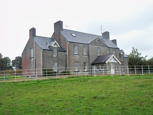 Ballymore Parkcountry house · 1310 yd
 Caher CastleCastle · 1411 yd
 IndicatedFairy fort / ringfort · 1440 yd
 Moyard WoodWood · 2.3 mi
 Athenry AbbeyHeritage attraction · 5.0 mi
 Athenry CastleHeritage attraction · 5.1 mi
 Kilcornan ForestWood · 6.2 mi
 MweenisharanIslet · 9.8 mi
 Roo Castle (in ruins)Castle, tower house · 1676 yd
Other information
Photo: Credit not shown in the picture search · Rights wording not checked; contact us if this picture should be removed