
Places near here
Photo credits
- National Inventory of Architectural Heritage
Explorer Tom Fairy fort in Coolacresig plans to retire by turning into a massive mossy hill and charging tourists entry fees for the…
Bullaun stone in ScronagareBullaun stone · 509 ydExplorer Tom The Bullaun stone in Scronagare is embedded in the top of a penitential mound, surrounded by quartzite on three sides.…
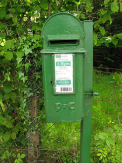 post box1458 yd
Explorer Tom Post box in Lackaneen is still doing its job from 1930, wearing raised Gaelic script like a very proud hat. It’s a…
 Bealahacreagh BridgeBridge · 1640 yd
Explorer Tom Bealahacreagh Bridge is a six-span stone giant from 1820 spanning the River Finnow. It’s got rubble walls and dressed…
 farm house1718 yd
Explorer Tom Farm house in Coolavokig is all about sheltering from the elements, which is basically its entire personality. It’s…
 Scoil Náisiúnta Cúil an Bhuacaigh [Coolavokig O'Donovan National School]School · 1724 yd
Explorer Tom Scoil Náisiúnta Cúil an Bhuacaigh is a 1901 school that’s currently vacant and looking a bit lonely. It’s got a central…
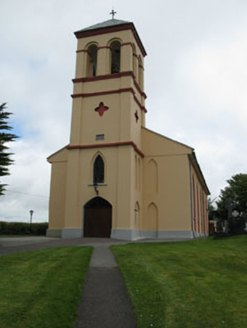 Séipéal Naomh Lachtáin [Saint Lachtáin's Catholic Church]Church/chapel · 2.1 mi
Explorer Tom Séipéal Naomh Lachtáin is the over-dressed uncle at the wedding who won’t stop talking about his marble reredos. It’s…
 Séipéal Naomh Lachtáin [Saint Lachteen's Catholic Church]Church/chapel · 4.3 mi
Explorer Tom Séipéal Naomh Lachtáin is standing proud like it owns the whole hill. It’s got that classic 'we are very important…
CastleCastle, unclassified · 4.4 miExplorer Tom Castle in Cúil An Mhothair makes the wild claim that it is older than the hills surrounding it, scattered with loose…
European long distance path E8 - part IrelandWalking route · 4.4 miExplorer Tom European long distance path E8 - part Ireland in County Cork is dreaming about winning the lottery and buying a private…
DerrineanigMountain / peak · 5.7 miExplorer Tom Derrineanig gave up its winter coat for Lent to impress the clouds, now it’s shivering in a thin scarf. It looks like a…
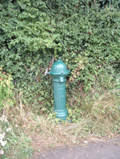 water pump13 mi
Explorer Tom Water pump in Mullaghroe North has been standing there since the 1880s, looking very Victorian about it. It’s a…
More archaeology and monuments in County Cork · All of County Cork

What do you know about this place?Tap to add a comment or ask a question