What is recorded here
Situated at the bottom of a steep E and NE-facing slope, and on the W bank of the N-S Mahon River with the stream immediately to the NE. This was first identified as a burnt spread by C. Moloney (2006) in testing (06E0163) on the line of a water pipe, and was completely excavated (05E1288) by L. Hackett (2009). An oval deposit of broken and burnt stones (dims. c. 15m E-W; c. 6m N-S; max. T 0.15m) overlaid an oval pit (dims. 1.1m x 0.7m; D 0.2m) and a subcircular pit (dims. 1m x 0.8m; D 0.45m). The mound was bordered by a revetment (L 4.5m E-W) of stakes and cut timbers at S which probably retained the hillslope. The burnt mound was sited on a larger mound of organic peatly material (T 0.4m), including brushwood, cut timbers and bone fragments. A sample of alder charcoal from the oval pit produced a C14 date of cal. BC 941-828.
Situated at the bottom of a steep E and NE-facing slope, and on the W bank of the N-S Mahon River with the stream immediately to the NE. This was first identified as a burnt spread by C. Moloney (2006) in testing (06E0163) on the line of a water pipe, and was completely excavated (05E1288) by L. Hackett (2009). An oval deposit of broken and burnt stones (dims. c. 15m E-W; c. 6m N-S; max. T 0.15m) overlaid an oval…
From the National Monuments Service (Archaeological Survey of Ireland) record WA024-121
The monument record does not grant public access. Check the route and ask the landowner before entering private land.
- What survives
- Recorded monument
Places near here
Fulacht fia in CarrickareadyFulacht fia · 328 ydMandevilles RockCastle, unclassified · 1067 yd farm house1312 ydchurch/chapel1669 ydCopper CoastCoastal geological landscape · 1.6 miBunmahon Miners' CottagesVisitor information · 1.6 miBunmahon StrandBeach / strand · 1.8 miBallydowane CoveBeach / strand · 2.2 miSt. Bernard's WellSpring · 2.4 miBoatstrand BeachBeach / strand · 3.8 miBallinageeragh DolmenArchaeological place · 4.7 miLime KilnVisitor information · 5.0 mi
 farm house1312 yd
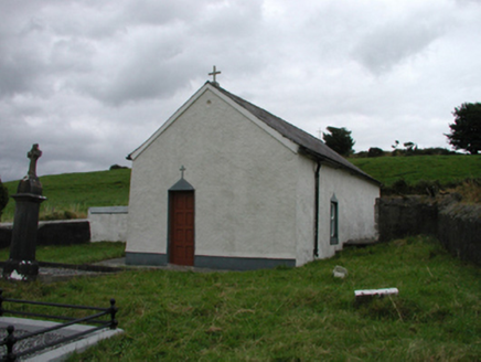 church/chapel1669 yd
 Copper CoastCoastal geological landscape · 1.6 miBunmahon Miners' CottagesVisitor information · 1.6 mi
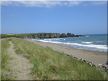 Bunmahon StrandBeach / strand · 1.8 mi
 Ballydowane CoveBeach / strand · 2.2 miSt. Bernard's WellSpring · 2.4 mi
 Boatstrand BeachBeach / strand · 3.8 mi
 Ballinageeragh DolmenArchaeological place · 4.7 mi
 Lime KilnVisitor information · 5.0 mi
Pictures: National Inventory of Architectural Heritage; Veekrokki, Wikimedia Commons · Public domain; Jonathan Thacker, Geograph · CC BY-SA 2.0; ethics girl, Geograph · CC BY-SA 2.0; Colin Park, Geograph · CC BY-SA 2.0; Alexander Redfern, Wikimedia Commons · CC BY-SA 4.0; Philip Halling, Geograph · CC BY-SA 2.0
More archaeology and monuments in County Waterford · All of County Waterford
What do you know about this place?