What is recorded here
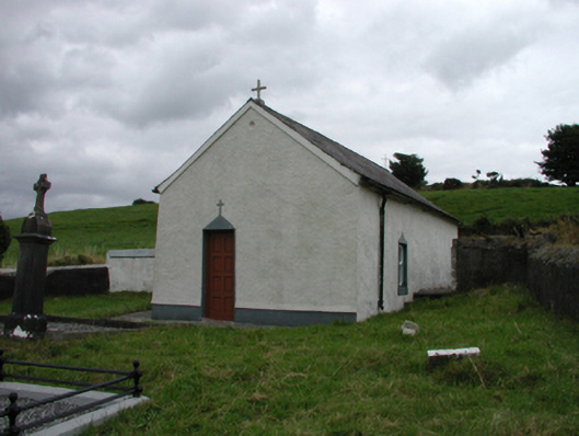
Detached two-bay single-storey single-cell Catholic church, c.1750, retaining some early fenestration. Renovated, c.1850. Extensively renovated, c.2000. Pitched roof with replacement artificial slate, c.2000, having cross finials to apexes, and cast-iron rainwater goods on slightly overhanging rendered eaves having wrought iron brackets. Painted replacement roughcast walls, c.2000. Square-headed window openings with rendered sills, rendered surrounds, c.1850, fixed-pane timber windows having diamond-leaded panels, and some replacement uPVC casement windows, c.2000. Square-headed door opening with rendered dressings, c.1850, and replacement timber panelled door, c.2000. Interior with carved timber pews, and painted stations. Road fronted at angle to road with unpainted rendered boundary wall to perimeter of site having rubble stone coping.(ii) Graveyard to site with various cut-stone grave markers, c.1750 – c.1900.
A small-scale church that is of considerable importance for its early age, representing one of the few surviving churches in County Waterford dating to the period pre Emancipation in 1829. The early period of construction is confirmed by the simple form and detailing to the composition, which relies primarily on the glazing patterns to the window openings for visual incident. The church makes a subtle statement in the landscape, and is complemented by an attractive graveyard containing markers of artistic design merit.
From the Buildings of Ireland (National Inventory of Architectural Heritage) record 22902510
This does not grant access. Most recorded buildings are privately owned; view them only from public ground unless the owner allows entry.
Places near here
Photo credits
- National Inventory of Architectural Heritage
- Veekrokki, Wikimedia Commons · Public domain
- Jonathan Thacker, Geograph · CC BY-SA 2.0
- ethics girl, Geograph · CC BY-SA 2.0
- Colin Park, Geograph · CC BY-SA 2.0
- Alexander Redfern, Wikimedia Commons · CC BY-SA 4.0
- Philip Halling, Geograph · CC BY-SA 2.0
- John M, Geograph · CC BY-SA 2.0
- Philip Halling, Wikimedia Commons · CC BY-SA 2.0
Enclosure in BallynagiglaEnclosure · 357 yd farm house752 ydfarm house869 ydCopper CoastCoastal geological landscape · 1.2 miMiners BucketVisitor information · 1.4 miBunmahon StrandBeach / strand · 1.5 miBallydowane CoveBeach / strand · 2.7 miBoatstrand BeachBeach / strand · 2.9 miBallinageeragh DolmenArchaeological place · 3.8 miLime KilnVisitor information · 4.1 miCastle (in ruins)Castle, tower house · 4.2 miDunhill CastleCastle · 4.2 mi
 farm house752 yd
 farm house869 yd
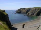 Copper CoastCoastal geological landscape · 1.2 miMiners BucketVisitor information · 1.4 mi
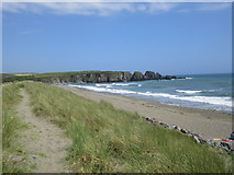 Bunmahon StrandBeach / strand · 1.5 mi
 Ballydowane CoveBeach / strand · 2.7 mi
 Boatstrand BeachBeach / strand · 2.9 mi
 Ballinageeragh DolmenArchaeological place · 3.8 mi
 Lime KilnVisitor information · 4.1 mi
 Castle (in ruins)Castle, tower house · 4.2 mi
 Dunhill CastleCastle · 4.2 mi
More historic places in County Waterford · All of County Waterford
What do you know about this place?