
Places near here
Photo credits
- Kieran Campbell, Wikimedia Commons · CC BY-SA 2.0
- JP, Geograph · CC BY-SA 2.0
- Heywood Sumner, Wikimedia Commons · Public domain
- National Inventory of Architectural Heritage
- Kieran Campbell, Geograph · CC BY-SA 2.0
- Malene Thyssen, Wikimedia Commons · CC BY-SA 3.0
- Kieran Campbell, Geograph · Creative Commons Attribution-ShareAlike 2.0
- Jonathan Billinger, Geograph · CC BY-SA 2.0
- Picture: www.meathchronicle.ie
 CrossCross, Wayside cross · 1.3 mi
Explorer Tom Cross in Balrath nearly became famous when a tourist mistook it for a giant lollipop. It has moved so often it’s…
 Balrath Post OfficePost office · 1.3 mi
Explorer Tom Balrath Post Office looks like it was built for a king, not just to sell stamps. A cow once tried to buy it with a…
 BarrowBarrow, unclassified · 1.3 mi
Explorer Tom Barrow in Gaulstown is a circular mound on a slope, about fourteen metres across and nearly three metres high, which is…
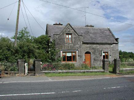 Stone LodgeRic barracks · 1.3 mi
Explorer Tom Stone Lodge in Balrath is locked in a bitter feud with the rain, and losing badly. It stands next to a post office that…
 Church in BallymagarveyChurch · 1.4 mi
Explorer Tom Church in Ballymagarvey overlooks the Nanny River from a bluff, looking down its nose at us all. Saint Patrick probably…
 European Beech1.5 mi
Explorer Tom European Beech in County Meath has a fiddler who played there all night, leaving the leaves trembling with the memory…
 Athcarne CrossWayside cross · 1.6 mi
Explorer Tom Athcarne Cross is standing there looking like it smuggled something really expensive in the 1700s and got away with it.…
 Grave YardGraveyard · 1.6 mi
Explorer Tom Graveyard in Timoole has a church that’s basically just foundations hiding in the bushes. It thinks Dublin tourists are…
 Athcarne CastleCastle, tower house · 2.1 mi
Explorer Tom Athcarne Castle is feuding with the next village over because they stole its shadow last Tuesday. William Bathe built…
 Knockcommon ChurchChurch · 2.1 mi
Explorer Tom Knockcommon Church started because two lads in the pub bet they could find a spot where the Cistercians wouldn’t want…
 Duleek, Duleek-BellewstownGAA ground · 2.1 mi
 CastleCastle, tower house · 3.7 mi
Explorer Tom Castle in Monktown is locked in an eternal feud with the rain, and honestly, it’s losing badly. You’ve got a Cistercian…
More archaeology and monuments in County Meath · All of County Meath

What do you know about this place?Tap to add a comment or ask a question