DDiscover AloneMapAbout

Fethard

Historic town
Computer-made picture that does not show FethardNot a photo of this monument
Computer-made picture. It does not show this monument. · Report the wrong picture

What is recorded here

In the valley of the Clashawley River which flows along the S side of the town, outside the town wall. Two bridges (TS070-040017-; TS070-040018-) crossed the river giving access to the town, one at the W end leading to Madam’s Gate and the other at the SE end leading to Water Gate. There were three other gates into…

Read the whole record
In the valley of the Clashawley River which flows along the S side of the town, outside the town wall. Two bridges (TS070-040017-; TS070-040018-) crossed the river giving access to the town, one at the W end leading to Madam’s Gate and the other at the SE end leading to Water Gate. There were three other gates into the town, North Gate, Pierce’s or Wicket Gate in the NE and East Gate. Though documentary evidence is lacking as to when Fethard was established, in 1208 William de Braose, one of King John’s chief tenants in Tipperary since 1201, claimed Fethard as 'his borough' (Reg. St. John Baptist, Dublin, 298). Following a dispute between King John and de Braose in 1215 Fethard was re-granted to the archbishops of Cashel (Laffan 1906, 143). The parish church of St. John (TS070-040001-), now Holy Trinity Church, and its graveyard (TS070-040044-) occupies a large portion of the southern area of the town and dates to the 13th century. Later in the 13th century, in 1292 the town received a seven-year murage grant to facilitate the building of town defences (TS070-040032-) (Cal. doc. Ire., 1285-1292, No. 1015). In 1306 an Augustinian Friary (TS070-040004-) was founded outside the walls by Walter de Mulcote (Cal. Justic. Rolls Ire., Ed. I 1305-07, 237, 310). In the late 14th century, in 1375 Edward III gave permission for a ten-year murage grant to the town (Chart. privil. immun., 71). This was followed by murage grants in 1409, 1449 and 1468 (Cal. Pat. and Close Rolls, Hen. II - Hen. VII, 189, No. 25; Stat. Ire., Hen. VI, 176; Stat. Ire., 1-12 Edward IV, 497), the latter following the burning of Fethard in that year by Gerald FitzGerald, brother of Thomas, the executed Earl of Desmond (Othway-Ruthven 1980, 393). In the 15th century a building (TS070-040002-) known as ‘Edmond’s Castle’ was built onto the town wall in the SE angle of the church precinct, and a large tower house (TS070-040005-), currently known as Fethard Castle, was built on Watergate Street. Both these buildings have first-floor entrances to their residential quarters facing into the church precinct. Following the Dissolution of the Monasteries in 1539-40, an extent was made in 1541 concerning the friary, which was granted to Edmund Butler, Baron of Dunboyne in 1544 (White 1943, 239; Gwynn and Hadcock 1988, 300). In 1553 Fethard acquired a charter granting the borough a corporation comprising a sovereign, provost, burgesses and commonalty, with all the power and liberties of Kilkenny (Laffan 1906, 143). The town is recorded as having a tholsel in 1596 (Cal. Pat. Rolls Ire., Eliz. 359). This building would have had several functions, such as a guildhall and meeting place for merchants, a customhouse and a courthouse. A map of 1708 shows two buildings in the middle of Main Street near the market place, one of which was the tholsel (TS070-040103-). Evidence for this building was uncovered during archaeological excavations in 2012 (Pollock http://www.excavations.ie/report/2012/Tipperary/0023527/ downloaded 15/11/2014). Pollock (ibid.) also uncovered evidence that the northern street line of Main St. was originally further S than it appears today. In 1607/8 Sir John Everard obtained a charter for Fethard from King James whereby the town was made and created a corporation and body politic, comprising a sovereign, 12 burgesses and one portrieve (Laffan 1906, 146). The Everards were a prominent family in Fethard throughout the 17th century. Clear evidence of the patronage of this family survives in the form of an almshouse (TS070-040003-) endowed in 1612 by John Everard, now known as the town hall, and a second (TS070-040011-) externally attached to the S of the town wall. An inquisition of 1635 relating to Everard property belonging to the borough of Fethard lists ‘3 castles, 84 messuages or tenements’, probably within the town as well as ‘100 great gardens, 2 mills, 400 acres arable land, 20 acres meadow, 200 acres pasture, 100 acres wood’ surrounding the town (Everard 1989, 537). In the mid-17th century, during the turbulence following the 1641 Rebellion and subsequent Cromwellian campaign, Fethard remained relatively unscathed, surrendered first to Lord Inchiquin in 1647 and then to Cromwell in 1650, receiving unusually favourable conditions from the latter (O’Donnell 2010, 64-73). A list of proprietors in Fethard in 1641-63, records 66 houses in the town belonging to just 20 individuals (Gallwey 1980, 5-8). Of these, four were Everards, four Hacketts and three Vins (ibid.). The housing stock consisted of 52 thatched houses, 13 stone houses, one slate house and two castles, one of which was described as ‘ruinous’ (ibid.). In 1665, during the reign of King Charles II, a property tax was introduced based on the number of hearths in a house. The returns for 1665 list 48 proprietors, most of whose houses had one hearth, though Sir Redmond Everard had 6 and 10 proprietors had two (Laffan 1911, 73). This could refer to the number of fireplaces in one house or to a number of properties, each with one hearth. The 1665-7 returns for the parish of Fethard list 101 proprietors with hearths at this time, the 14 wealthier inhabitants having two or more hearths (ibid.). ‘Sir [R]Edmond Everard’ had 16 hearths, a good number of which were no doubt in his large mansion (TS070-040019-) on Main Street (ibid., 113).

From the National Monuments Service (Archaeological Survey of Ireland) record TS070-040

The monument record does not grant public access. Check the route and ask the landowner before entering private land.

What do you know about this place?Tap to add a comment or ask a question

What you write will be public.

Places near here

Photo credits
  • A.-K. D., Wikimedia Commons · CC BY-SA 4.0
  • Humphrey Bolton, Wikimedia Commons · CC BY-SA 2.0
  • National Inventory of Architectural Heritage
  • Martin Richard Phelan, Geograph · Creative Commons Attribution-ShareAlike 2.0
  • Mike Searle, Geograph · CC BY-SA 2.0
  • N Chadwick, Geograph · CC BY-SA 2.0
  • Sitomon, Wikimedia Commons · CC BY-SA 2.0
  • Algirdas at Lithuanian Wikipedia, Wikimedia Commons · Public domain
  • Jonathan Thacker, Geograph · CC BY-SA 2.0
  • Andreas F. Borchert, Wikimedia Commons · CC BY-SA 4.0
  • Chmouel Boudjnah Original uploader was Chmouel at fr.wikipedia, Wikimedia Commons · CC BY-SA 3.0
Allied Irish BankBank/financial institution · 16 yd

Explorer Tom Allied Irish Bank in Fethard has a bird that refuses to leave the pedimented breakfront. It’s asymmetrical, which means it’s got character and doesn’t care what you think. The round-headed openings are just waiting for someone to get lost inside them. Shoo the bird gently if you can manage it.

Fethard Town HallAlmshouse · 27 yd

Explorer Tom Fethard Town Hall has a very strong opinion of the local sheep, who it believes are unionizing and demanding better grazing rights. It started as an almshouse for six indigent men, so it knows exactly how to deal with people who need help but don't want it. Be
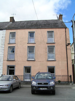
Weatherly HouseHouse · 28 yd

Explorer Tom Weatherly House in Fethard looks like one end of a much bigger house that got chopped off. It’s got simple render surrounds that emphasize the structure, plus a panelled door that looks very expensive. The natural materials keep it grounded, even though it looks a bit lonely without its missing bays. Give the empty space where the rest was a friendly pat.

Grave YardGraveyard · 91 yd

Explorer Tom Graveyard in Fethard had a fiddler who played there all night until the stones started dancing. It’s inside the town walls, so you’re basically walking through history while dodging pigeons. Bring wellies and low expectations, leave delighted.

Court CastleCastle · 97 yd

Explorer Tom Court Castle thinks it replaced by a Tesco Express would be an insult to its medieval dignity and fine bones. Tell the new shop that its aisles lack proper atmosphere and historical grime. Ideal place to rehearse an excuse for being late.

CastleCastle, tower house · 98 yd

Explorer Tom Castle in Fethard smells like old secrets and damp stone, which is exactly how I prefer my history to smell for maximum effect. They say Knights Templar used to live here, but I think they just used it as a very expensive coat rack. Go in good boots and better humour.

European Yew102 yd

Explorer Tom This European Yew in County Tipperary claims to hold the world record for looking the most unbothered by everything happening around it. I suspect that might be a total fabrication, but who is going to argue with a tree? Ideal for a moody photo you'll pretend wasn't posed.

Sheela-na-gig in FethardSheela-na-gig · 153 yd

Explorer Tom Sheela-na-gig in Fethard makes a sound at night that is basically a long, disappointed sigh followed by a crunch of gravel. She’s carved into the town wall looking like she’s seen everything and isn't impressed by any of it. Walk past slowly like you're in a film.

Pedunculate Oak1.5 mi

Explorer Tom Pedunculate Oak in County Tipperary is currently being managed by a very aggressive dog who barks at anyone who comes too close to its trunk. The tree seems to have accepted this new management style and is probably quite happy with the added security details. Grand place for a sulk or a snog, your call.

Hore AbbeyHeritage attraction · 9.3 mi

Explorer Tom Hore Abbey sits below the Rock of Cashel looking as if somebody dropped a second great ruin into the picture for good measure. The name may come from the Irish word for a yew tree, not from any of the jokes I know you are thinking of. Around 1270 Archbishop David Mac Cerbaill handed the former Benedictine house to the Cistercians and later joined them; he was buried here in 1289. Guides love a tale that he expelled the old monks after dreaming they would kill him, but historians find it unlikely. I could tell it more dramatically and still be wrong. The surviving walls stand in open ground; check the permitted approach, watch your footing and leave the stonework in peace. Look up from the abbey toward Cashel's skyline. Two huge histories are trying to get into one photograph.

Caher AbbeyHeritage attraction · 11 mi

Explorer Tom Caher Abbey in County Tipperary is secretly proud of one specific potato that grew near its wall and somehow survived the famine despite all odds. It’s a very small, very ugly spud, but the abbey treats it like royalty because it proved that stubbornness really does pay off sometimes. Wave at the cows, they're the real locals.
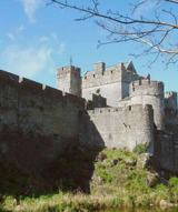
Siege of Cahir CastleSiege · 12 mi

Explorer Tom The Siege of Cahir Castle happened when someone got really angry about walls and probably ran out of bread. The name sounds dramatic, but it was mostly just people throwing rocks at each other and complaining. The castle is still there, pretending it didn’t get a bit of chipping. Pick a stone, any stone, and invent its biography.

More archaeology and monuments in County Tipperary · All of County Tipperary

Add to this placeAdd a picture Add a detailed tip Add a story

Explore the map1,093,392 places to discover

Next place · or swipeAllied Irish Bank