What is recorded here
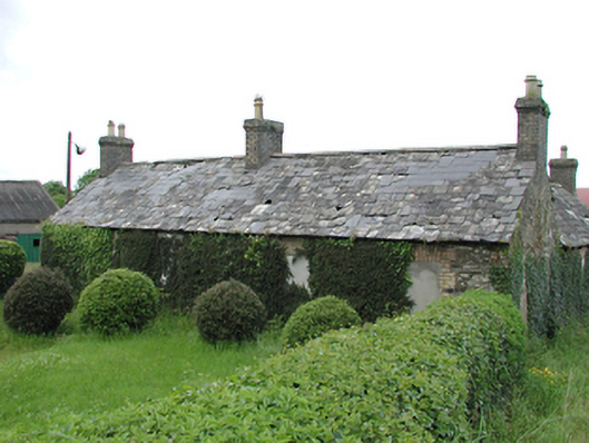
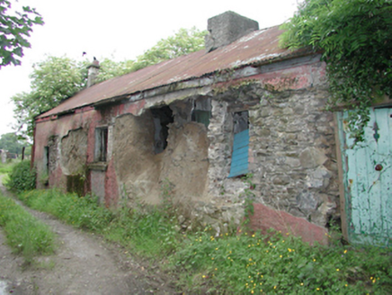
Detached four-bay single-storey former farm house, c.1860, now abandoned. Stone rubble walls with brick dressings to cemented over openings. Pitched slate roof, partially repaired in artificial slate, and beige brick chimney stacks to each gable end and centre. Another farm house to the east of similar construction with a brick eaves course. Four-bay single-storey outbuilding facing road, with roughcast rendered walls, corrugated roof, and some original timber casement windows.
These former farm houses and outbuildings add character to this rural landscape as an example of an increasingly rare settlement pattern.
From the Buildings of Ireland (National Inventory of Architectural Heritage) record 11219001
This does not grant access. Most recorded buildings are privately owned; view them only from public ground unless the owner allows entry.
Places near here
Photo credits
- National Inventory of Architectural Heritage
- Mike Searle, Geograph · CC BY-SA 2.0
- Sitomon, Wikimedia Commons · CC BY-SA 2.0
- Colin Park, Geograph · CC BY-SA 2.0
- JP, Geograph · CC BY-SA 2.0
 farm house624 ydLinear earthwork in Crooksling,sladeLinear earthwork · 649 ydIndicatedHoly well · 666 yd
 EmbankmentHouse · 774 ydVerschoyle's HillMountain / peak · 1204 ydCastleCastle, tower house · 1364 ydRathcoole WoodlandWood · 1.2 miMeadow WildlifeVisitor information · 1.2 mi
 CastleCastle, tower house · 3.6 mi
 European Yew3.6 mi
 Cupidstown HillMountain / peak · 3.9 mi
 Grand Canal WayWalking route · 4.2 mi
More historic places in County Dublin · All of County Dublin
What do you know about this place?